€ 35
€ 58
The Caldenave Refuge is located in a happy and pleasant position on a hill overlooking the two plains where domestic and wild animals live in harmony. The location of the refuge allows lovers of nature and historically valuable environments to go on more or less demanding excursions. Even those who simply love silence, peace and tranquility will find the surroundings of the refuge the right place to regenerate, rest and enjoy a dish of Alpine cuisine. The refuge is a stop on several Alte Vie. The building was created from an ancient, well-restored hut. It has 22 beds distributed in five rooms with common services. The restaurant offers simple and traditional dishes, prepared with genuine ingredients of local origin. Guido, the new manager, will help you discover the many secrets of the place.
Read everythingFrom Trento or Bassano, once you reach the crossroads for Strigno, take it and continue until the signs for Spera. From Spera you go up Val Campelle to the Tedon area (200 meters before the Carlettini refuge, possibility of ample parking and indicative tables). From the car park of the Alpine colony to the Caldenave plain in an hour and a half of easy walking (458 meters in altitude) along path 332.
Read everything
The Caldenave refuge is a stopover for three high routes:
www.lagoraipanorama.it
www.altaviadelgranito.com
www.lagoraipanorama.it/altaviadelcentenario/altaviadelcentenario.html
Lakes of the Val dell'Inferno Difficulty: 1 Walking time: 2 hours (3 hours with Lake Nassere) The difference in altitude: 200 meters Place of departure: Rif. Caldenave (m. 1,792) Place of arrival: Lakes of the Val dell Inferno (m .1960) The highest point: m. 1,960.
Description: From the Caldenave Refuge, along path 360, in about an hour of easy walking, climb to the lakes of the Val dell’Inferno, an enchanting and enchanted place, inhabited by elves, fairies and a great multitude of princes transformed into alpine newts. You can go back to the refuge by the way up, or go up to Lake Nassere, passing through the Baito dei Lastei, then go down to Malga Nassere along the Nomadi path and return to the refuge, or go directly to the Tedon parking lot. Pleasant and undemanding excursion. 3 hours of walking from the refuge. Suitable for everyone.
EE - Giro delle Forcelle Difficulty: 2 Walking time: 6 hours Difference in altitude: 950 meters Place of departure: Ref. Caldenave (1,792 m.) Place of arrival: Ref. Caldenave (m. 1,792) The highest point: Cimon Rava m. 2.436 Description Wonderful and rewarding ring ride. From the Caldenave refuge, climb to Forcella Ravetta along path 332 which runs through the beautiful valley of the same name. From here, at altitude, along the path 332B and 328 you reach Cimon Rava (with a small detour to admire the wonderful panorama of the Val di Rava and its characteristic lakes) and then Forcella Quarazza. For an easy path, continue to Forcella Segura and then descend into the Orsera fork below (path equipped with steel cord). Continue on path 373 passing under Cima Orsera and Cima delle Buse Todesche to Forcella delle Buse Todesche. From here, along the panoramic path 360, you descend to the lakes of the Inferno Valley passing through the Baito dei Lastei to the Caldenave Refuge. Excursion that requires some training. All day.
E - Cresta del Frate Difficulty: 2 Walking time: 6 hours and 40 minutes The difference in height: 1050 meters (with some ups and downs) Starting point: Rif. Caldenave (1,792 m.) Place of arrival: Rif. Caldenave (1,792 m. ) The highest point: Forzelon di Rava m. 2.397 Description From the Caldenave Refuge go up to Forcella Ravetta (2,219 m.) Along path 332 which runs through the beautiful valley of the same name (about an hour). From here, at high altitude, along the panoramic path 332 you reach the Forzelon di Rava (2,397 m / 45 minutes) and continue to the Tombolin Pass (366 bis / 20 minutes approximately). Here begins the spectacular "Cresta del Frate" which, along ledges and walkways dug out of granite, reaches the characteristic Cima del Frate and then continues along the 366 bis to Forcella Fierollo (2,246 m / 2 hours). From Forcella Fierollo, continue along path 366 to Malga Rava di Sopra (Bivouac, 2,030 meters) and then descend along path 365 in a westerly direction, until you intersect path 332 which goes back to Forcella Ravetta (about 2 hours). From here, in forty minutes, you return to the Caldenave refuge. All day.
EE - Cima Orsera Difficulty: 2 Walking time: 4 hours Difference in altitude: 680 meters Place of departure: Rif. Caldenave (1,792 m) Place of arrival: Cima Orsera (2,471 m) The highest point: Cima Orsera (m 2.471) Description From the Refuge go up to Val Orsera following the SAT 373 / Bis (EE) path. When you reach the Orsera fork (2,305 m / 30 minutes), cross path 373. Follow it northwards until you cross a wooden bridge. A little further on, a trace of a path on a grassy slope, in thirty minutes, leads to the top occupied by war fortifications and an exceptional panoramic point. Return via the ascent route, or by returning on path 373 to continue towards Forcella delle Buse Todesche, Val dell’Inferno to the refuge. Excursion for everyone of normal effort achievable in half a day.
Other numerous excursions will be revealed to you by Guido, the manager.
Open from late May to early October.

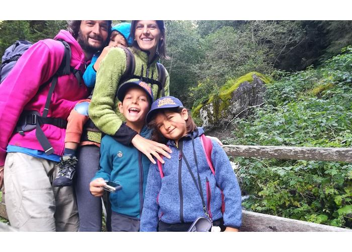
After 20 years in the Dolomites, it is with great enthusiasm and energy that I begin this new adventure with my family, Alice, my wife, Edoardo, Gilda and Achille, our children. We think that the refuge is the mountaineer's home, we believe in the refuge as a place of receiving and sharing spaces, ideas, emotions and life.