MAZZIN DI FASSA | Telefono: +39 0462602272 | Cellulare: +39 3336656311
![]()
![]()
-
-
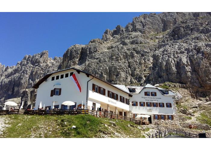
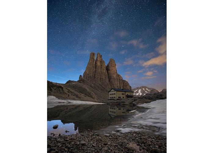
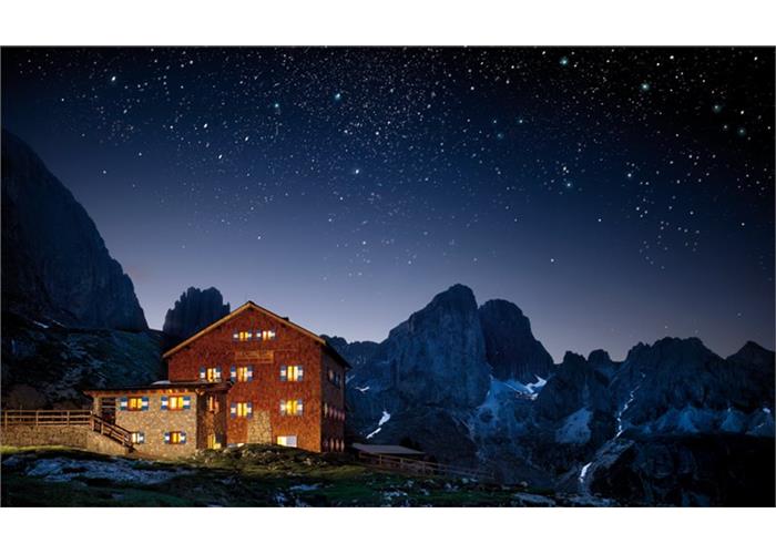
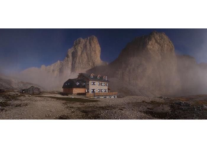
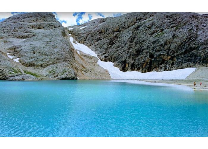
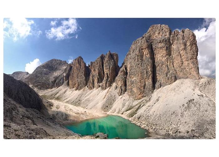
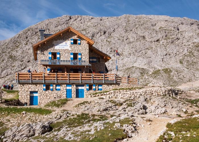
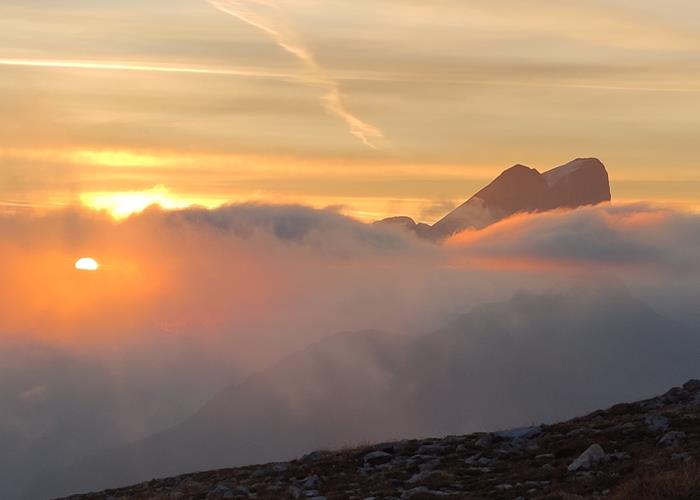
The Antermoia refuge is located at an altitude of 2,496 meters. in the eastern part of the Catinaccio. One step away from the refuge lies the lake of Antermoia, one of the highest lakes of the Dolomites of glacial origin which with its emerald-colored waters leaves anyone enchanted. The refuge was rebuilt and expanded in 2015/16 to meet the needs of those who frequent it. It is an excellent starting point for the via ferratas of the Catinaccio di Antermoia and Laurenzi, for numerous excursions of easy and medium difficulty and a destination refuge for the Alta Via of the Dolomites.
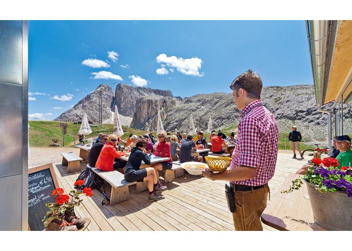
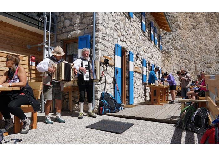
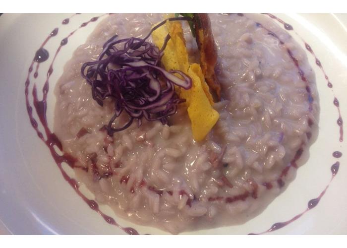
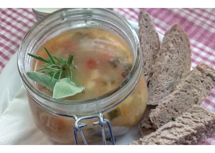
The Refuge gives the opportunity to taste typical dishes of the Ladin culture flanked by traditional cuisine, as well as homemade desserts. The refuge offers various types of regional and national wines.
In the kitchen, importance is given to the selection of fresh and quality products.
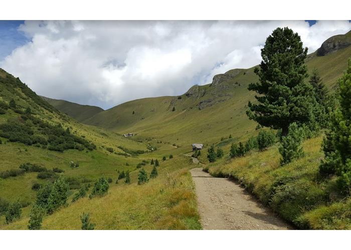
FROM CAMPITELLO DI FASSA TO VAL DURON Go up the Val Duron which starts under the church of Campitello. Once you reach the plain of the Valley, you pass the typical Baita Lino Brach up to a small bridge with a trail marker that crosses the Rio Duron on the left. Following the path no. 578 go up through woods and meadows to Pas de Ciarejoles. Going up the easy path no. 580 in the scree you reach the Pas de Dona where the Valon de Antermoa opens and you will soon reach the refuge. 3.30 The first part of the ascent of Val Duron can be avoided by using the convenient shuttle service that leads to the entrance to the plain of Val Duron from there the climb is 2.45 hours
FROM MAZZIN DI FASSAPER VAL UDAI In the upper part of Mazzin the Udai valley starts, path 579 runs along the entire first part of the Udai stream up to L 'Pisc (waterfalls) From there, path 57 goes up through the meadows sometimes even steep up to come out on the plain that connects with the lateral Val de Dona (Loc. Camerloi) Going up the easy path no. 580 in the scree you reach the Pas de Dona where the Valon de Antermoa opens and you will soon reach the refuge. 3.00
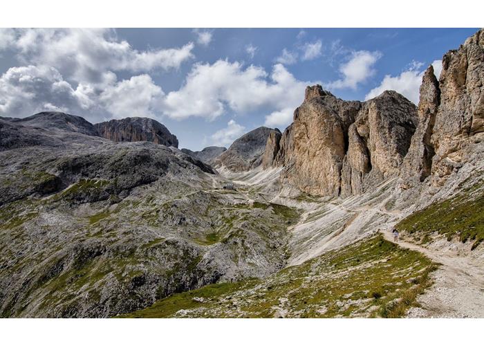
FROM PERA AND VIGO TO THE VALLEY OF THE VAIOLET From Vigo a comfortable chairlift takes you up to 1,980 meters. del Ciampedie continue along an easy path no. 540 flat leading to loc. Gardeccia 1.950 mt. The same point can also be reached from Pera di Fassa by shuttle bus. From Gardeccia a road n. 546 climbs towards the Vajolet valley, passing the Vajolet and Preuss refuges passing under the Vajolet Towers and continuing uphill on path 584 for the Antermoia Pass 2,760 m. passing it and descending into the fascinating Valon de Antermoa. In short you arrive at the Antermoia lake and the refuge. 4.00 - 4.30
11 BEDROOMS - 62 BEDS - BATHROOMS WITH HOT SHOWER ON EVERY FLOOR
Read everything
FROM THE ANTERMOIA REFUGE TO THE ALPE DI TIRES From the refuge along the path no. 580 in a north-easterly direction you will soon reach Pas de Dona, descending the path northwards you will reach Pas de Ciarejoles, at the crossroads with signpost follow the path nr. 555 towards Alpe di Tires. After reaching the bottom of the valley, go up the easy road no. 532 and then 594 at the Tires pass.
FROM THE ANTERMOIA REFUGE TO THE PASSO DELLE SCALETTE A few meters from the refuge, path no. 583 for the Passo delle Scalette. Going up the well-marked path to the southwest, you reach Pas de Laussa at an altitude of 2,709 meters. From here, always in a southerly direction, descend into the valley of Lago Secco, continuing to reach Passo delle Scalette where a short stretch of aided path leads us back to Gardeccia along an easy path in a dense vegetation of pines. 3.00
VIE FERRATA Via ferrata dell'Antermoia - Via ferrata Laurenzi
CLIMBING ROUTES South and west walls of the Mantello South wall of the Croda del Lago Testone of the Torre Fiorenza refuge There are beautiful classic multi-pitch climbing routes of various difficulties from grade III to VI. The reports will soon be available on the refuge site. Furthermore, there are areas of bolted sport climbing throughout the Vallone.
Open from June to October.
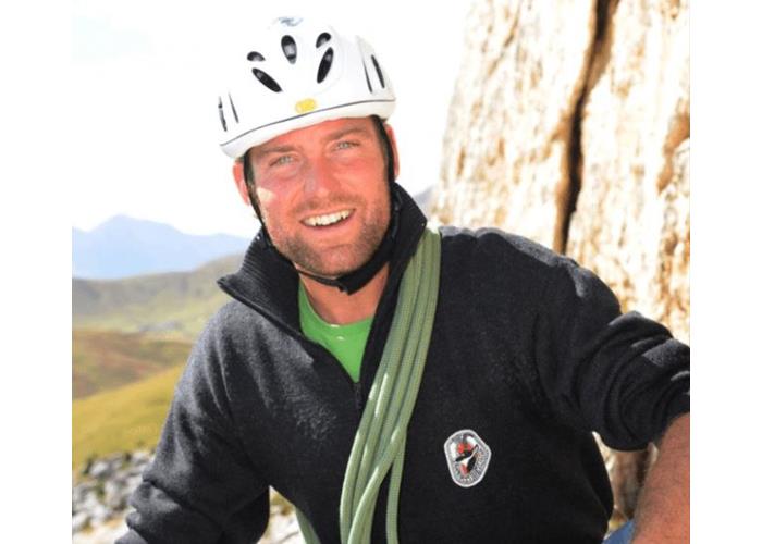
Martin Riz, mountain guide and member of the mountain rescue team (which coordinates for the Val di Fiemme and Fassa area).
Enter our shop to buy our gadgets, items for the mountains, stay packages in one of the mountain huts that are part of mountbnb.
Buy now
![]()
![]()