Vigo di fassa | Telefono: +39 0462 764450 | Cellulare: +39 3356750325
![]()
![]()

€ 33,5
€ 52
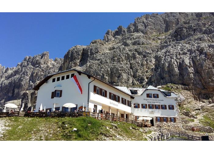
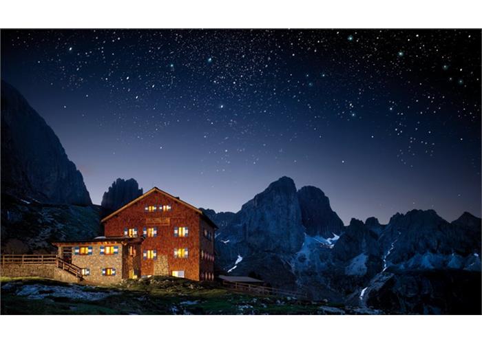
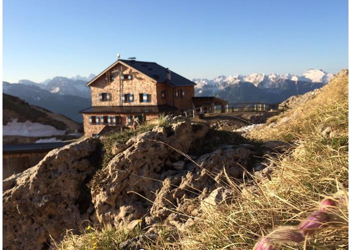
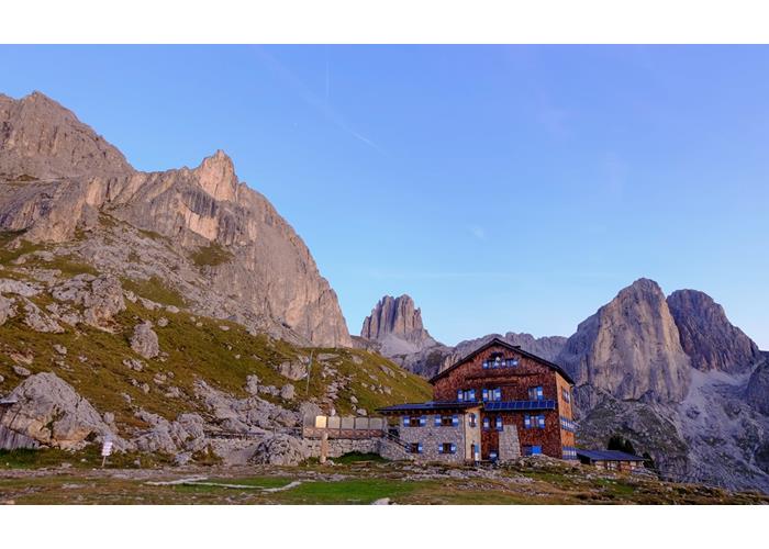
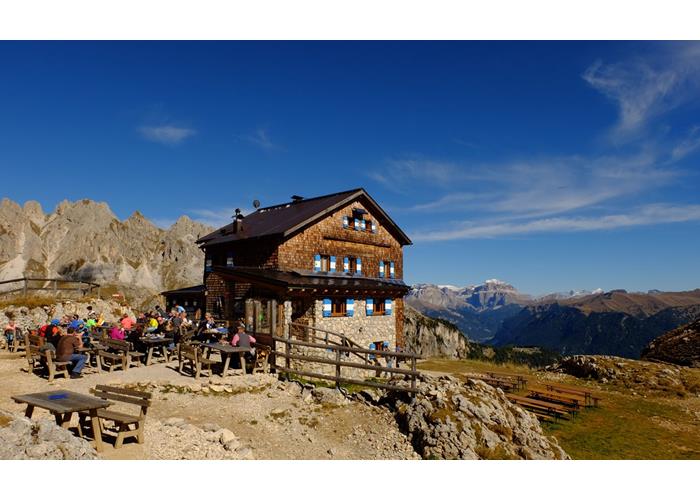
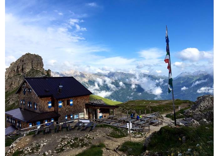
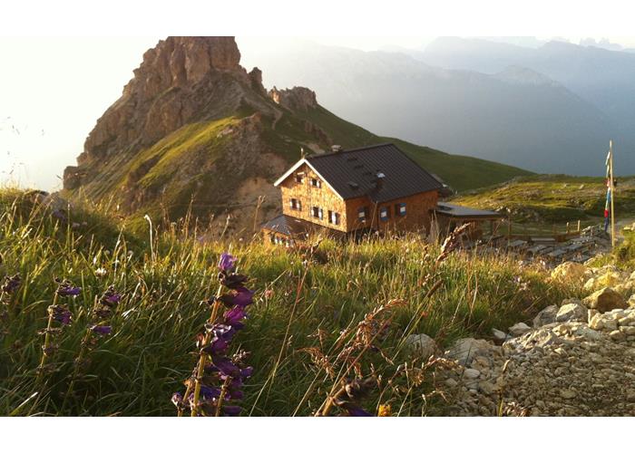
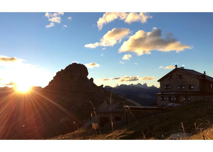
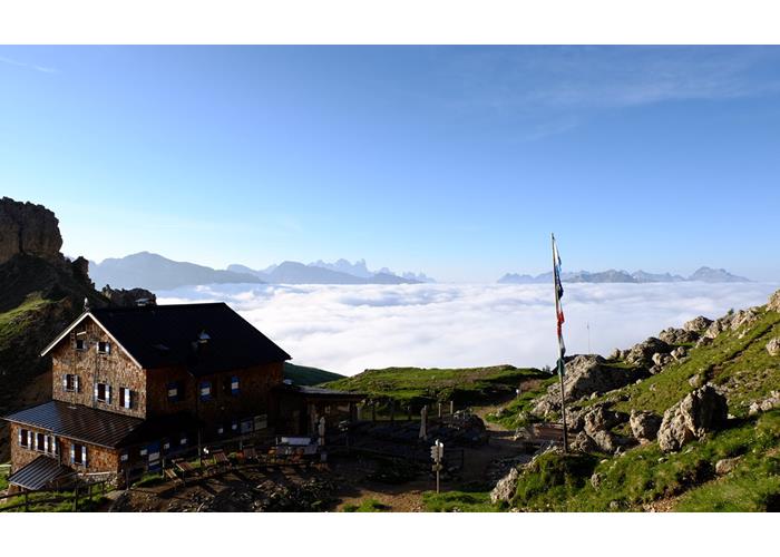
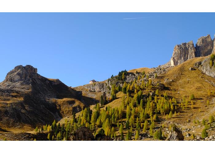
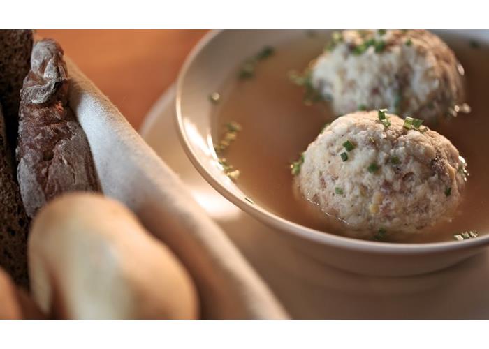
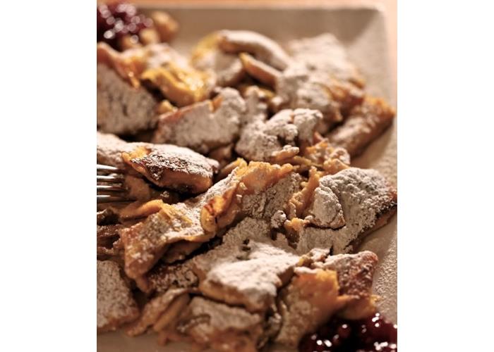
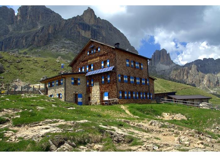
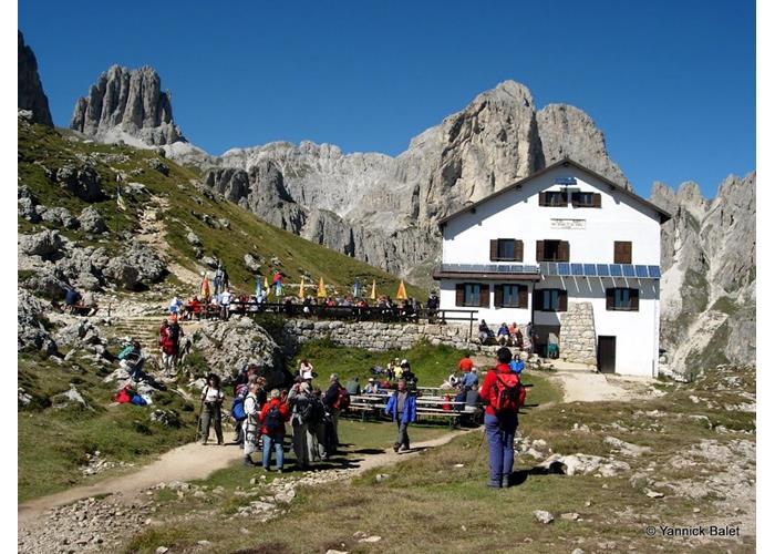
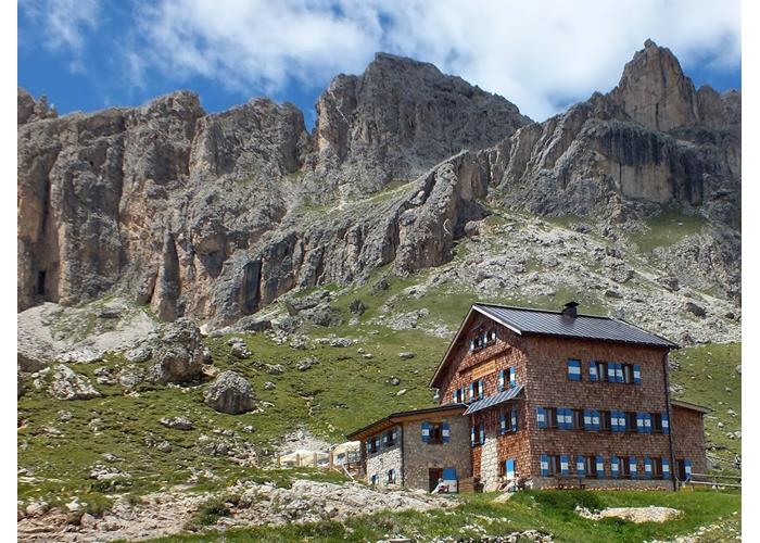
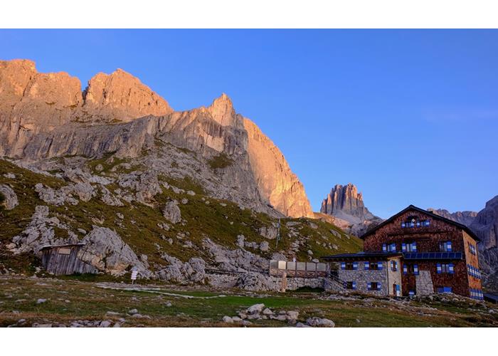
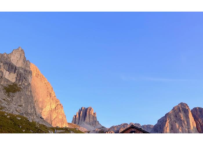
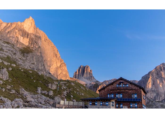
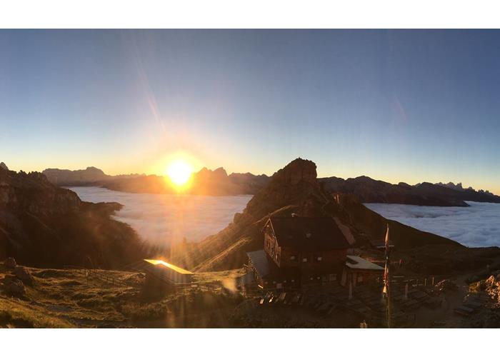
The Roda Di Vael refuge is located on the Sella del Ciampaz at altitude 2283m, situated in a strategic position in the heart of Catinaccio. It allows easy accesses and it’s a perfect starting point on the one hand for those who want to live the mountains climbing or doing rail corridors, and on the other hand for those who simply want to enjoy a lovely walk admiring the awesome panorama of the tops of Dolomiti, heritage of UNESCO. It’s one of the referring refuges for the Gruppo del Catinaccio and when it has been enlarged and modernized, the room was entitled to to one of the most talented climbers of the history of dolomitic alpinism: Marino Scenico. Even today the paths of Marino Scenico are selectives. We suggest the typical local cuisine (even for celiac) and warm and friendly welcome. You’re welcome!
Read everything
From the Costalunga pass: from Bolzano via Val d'Ega: from the A22 motorway (Autostrada del Brennero) exit at Bolzano Nord, follow the signs for Val d'Ega - Carezza (S.S. 241). Val d'Ega is a narrow valley that leads up to Nova Levante. From Nova Levante the road continues up to the Costalunga pass (located already in the municipality of Vigo di Fassa) for a total of 28 km. From the Costalunga pass the road continues to reach Vigo di Fassa in another 9 km. From the exit of Bolzano Nord to the Pass, about 20-25 minutes.
From Vigo di Fassa: From the A22 motorway (Autostrada del Brennero) exit at Egna-Ora, follow the directions for Val di Fiemme - Val di Fassa (S.S. 48). You reach Vigo di Fassa by crossing, Passo San Lugano, Val di Fiemme, Val di Fassa in about 55-60 minutes (55km from the motorway exit). In both cases there are different solutions for difference in height and travel time.
From the Costalunga Pass: 1st Path No. 548 - Difference in height 530 mt. - Journey time 1.30 hours approx. - Distance 3.5 Km. Departure from the Costalunga Pass 1745 m, signposted 548 - 1.30 pm It starts near the Costalunga Pass, just below the Pass on the Fassano side (about 200 meters, evident the entrance of the path in proximity to a widening / dirt parking). From here follow the forest road (trail sign no. 548 - signs Roda di Vael) and soon reach the junction with path 552. Left the trail mark 552, continue along a debris area, then a small valley; in the locality of Paschè 2005 m. continue on the path through the valley. You gain altitude with increasing view reaching the Sella del Ciampàz, with the nearby lookout of Ciampàz. Here is the Roda di Vaèl refuge (2283 m).
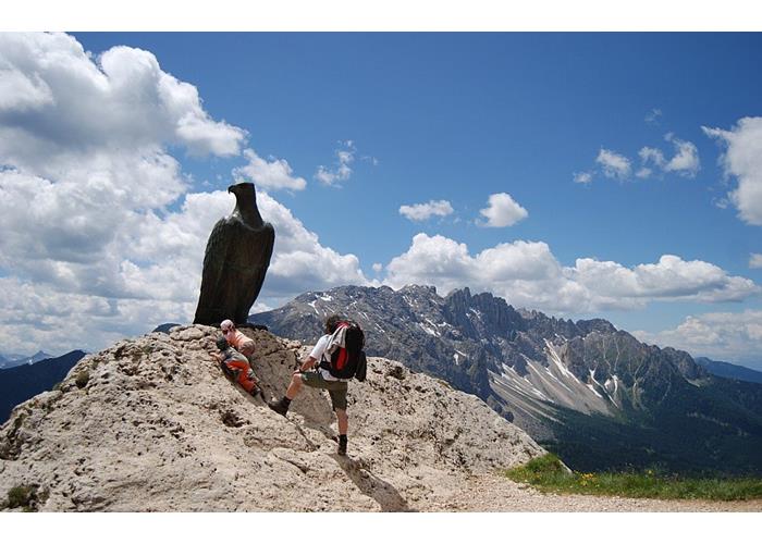
2nd Path n. 539 before and n. 549 then, climbing up to the Paolina hut with the chair lift of the same name - Altitude 150 m. - Travel time 0,45 hours approx. - Distance 2 Km. Just below the Costalunga Pass on the slope of Nova Levante (near the Hotel Karersee), there is the Paolina chair lift which leads in a short time and with a breathtaking view to the Paolina Refuge. From the Refuge Paolina, 2125 m, take the path 539 which starts a few meters in front of the arrival of the chairlift, with a turn to the right immediately at the beginning. You go up the pastures under the Punta del Masarè visible to your left, while on the right the eye will touch the Latemar group with the great landslide on its slopes. You get to the monument to Theodor Christomannos, pioneer of dolomite tourism: a large bronze eagle placed at an altitude of 2349 m. At this point the bulk of the difference is now done! Continue to the right on the trail marked 549 (Sentiero del Masarè) in an open environment with a beautiful view on the valley floor, until you reach the saddle with the Roda di Vaèl refuge 2283 m (45 min from the Paolina hut).
From Vigo di Fassa: 1st Path n. 547 before and n. 545 then - Difference in level 900 m. - Journey time 3 hours approx. - Distance 5 Km. Departure from Vigo di Fassa 1382 m, in the village of Valle. From here starts the trail 547 which, intersecting the forest road that goes up to the Vael hut, leads us to reach the path 545 that leads us to the shelter in about 3 hours and overcoming a considerable difference in height. Path 547 suffered a large landslide last winter (beginning of 2014), just above the village of Vigo di Fassa. It is therefore necessary to inquire on site about your access point and conditions of accessibility.
2nd Path n. 545, climbing up to the Ciampedie with the homonymous cableway - 300 meters difference in height. - Journey time 1.30 hours approx. - 4.5 Km. From the center of the village of Vigo, take the cableway that leads to the Ciampedie (parking at the cableway). From the arrival of the Ciampedie cable car at an altitude of 1.950 m, continue up the green meadows towards Prà Martin and then take the path 545 that leads along the long valley to the Malga Vael and then with steep slope to the Rifugio Roda di Vael
Ciampedie hours 1.30-1.40. 3. "Vial de le feide" (Trail of the Sheeps), climbing up to the Ciampedie with the homonymous cableway - Difference in height 300 meters. - Journey time 1.30 hours approx. - Distance 4.5 Km. From the center of the village of Vigo, take the cableway that leads to the Ciampedie (parking at the cableway). From the arrival of the Ciampedie cable car at an altitude of 1.950 m, continue going up the green meadows towards Prà Martin and then take the "Troi o Vial de le Feide" (Sentiero delle Pecore) at the foot of the Cigolade and Pale Rabbiose. When you reach the Buja de Vael, you cross the path 541 which you take left to take you comfortably to the Rifugio Roda de Vael. From the Ciampedie hours 1.30-1.40.
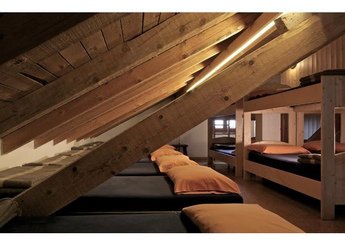
3 bedrooms and 3 dormitories / 59 total beds / 3 bathrooms with hot shower
Read everything
- Tour of Vajolon - short hike approx. 3h Starting from the hut with the paths 541 first and then 551, we reach the Passo del Vajolon (2560 m) in approx. 1h and 30 min. We descend along the path that crosses the scree below the imposing Roda di Vael wall to the path 549 "Majare path" (Hirzelweg) and continue towards the monument dedicated to Christomannos (large bronze eagle) in approx. 1h. From here to the refuge for an easy path in approx. 30 min.
- Giro delle Cigolade - short hike approx. 3h Starting from the shelter on path 541, passing under the overhanging walls of the Mugoni, we reach the Passo delle Cigolade (2579 m) in approx. 1h and 15 min. We continue to the Vial delle Feide (sheep trail), and through the Passo del Soffion we turn around the Pale Rabbiose. We return to the refuge on the comfortable and scenic trail completing the tour in approx. 3h.
- Ferrata Roda di Vaèl - Masarè (5/6 h) To all those who want to travel these beautiful and scenic paths, we recommend starting from the Vaiolon pass. The departure can be reached from the mountain station of the Paolina chairlift (1.30) or from the Roda di Vaèl refuge (1.15). From the pass of the Vaiolon for an easy equipped path you reach the summit in about 45 minutes, and, after crossing the cross that borders the summit, follow the trail to the Rode pass. After the short but exposed paretina (more challenging section of the entire route), for easy trail descend until you find the junction that offers us the opportunity (recommended in case of bad weather) to get off at the Roda di Vaèl and finish the first long part the equipped but challenging channel or to continue on the Cres del Majarè. This second part, more demanding than the first, allows us to walk up and down the various towers that act as a natural divide between the province of Trento and that of Bolzano and to enjoy the whole route of a wonderful landscape. At the end of the via ferrata in about 30 minutes you will descend to the Ciampaz saddle, reaching the Roda di Vaèl refuge and the Baita Pederiva.
End of May - Mid October

Enter our shop to buy our gadgets, items for the mountains, stay packages in one of the mountain huts that are part of mountbnb.
Buy now
![]()
![]()