Marebbe | Telefono: +39 347 5214753 | Cellulare: +39 3475214753
![]()
![]()

€ 35
€ 55
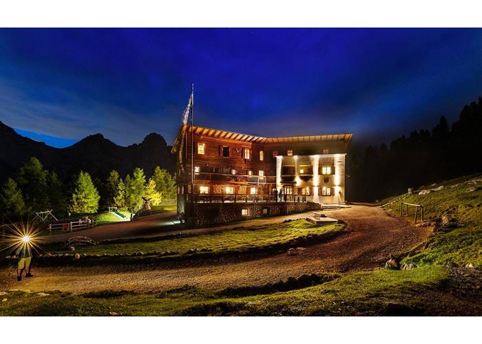
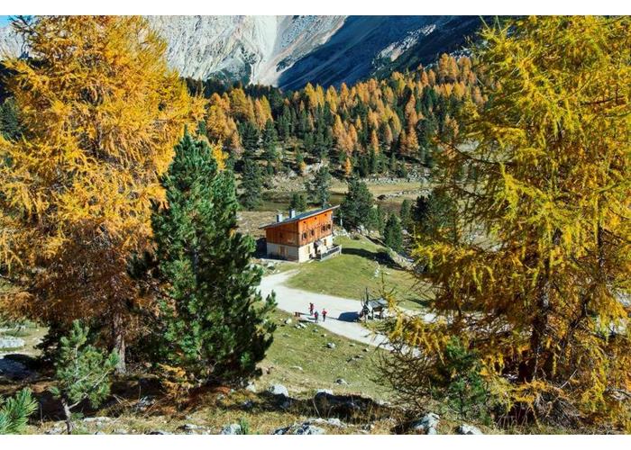
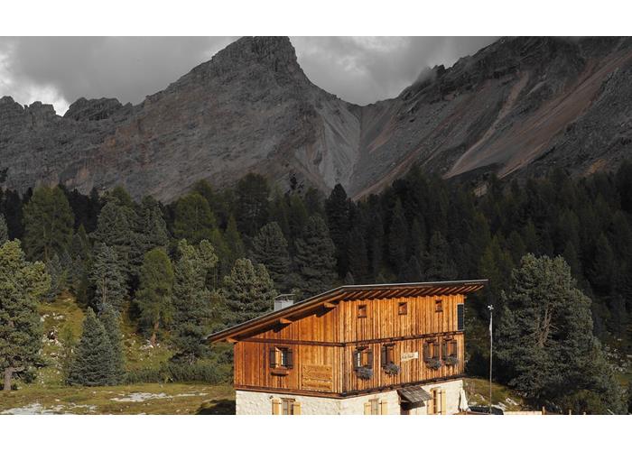
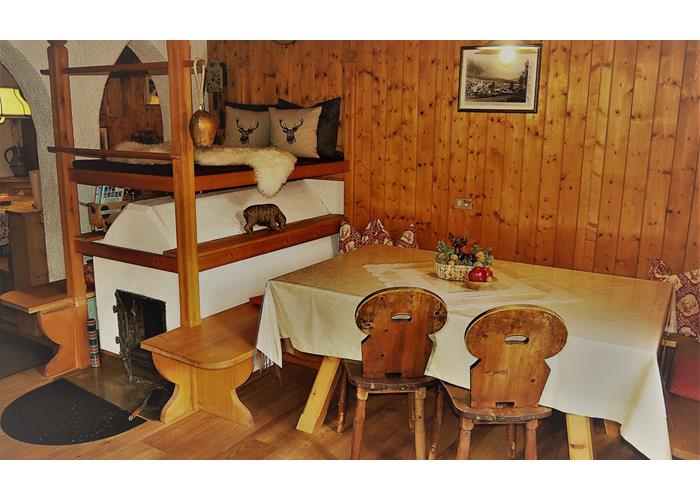
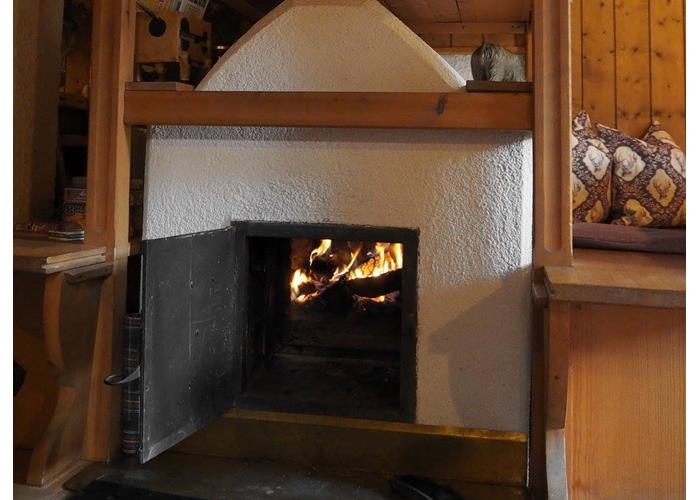
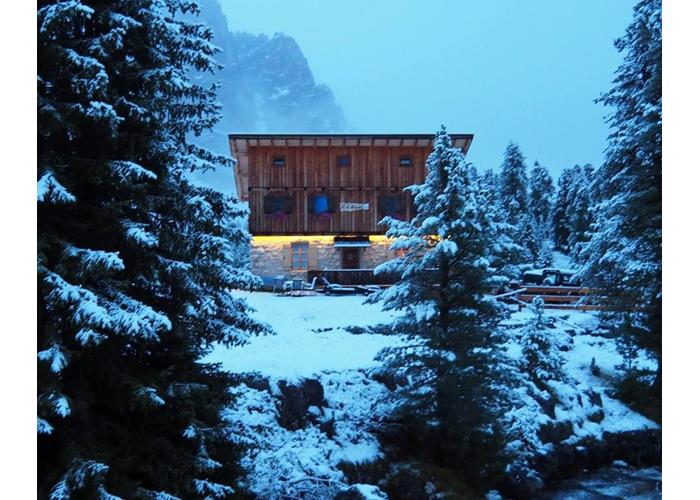
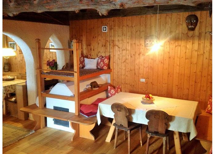
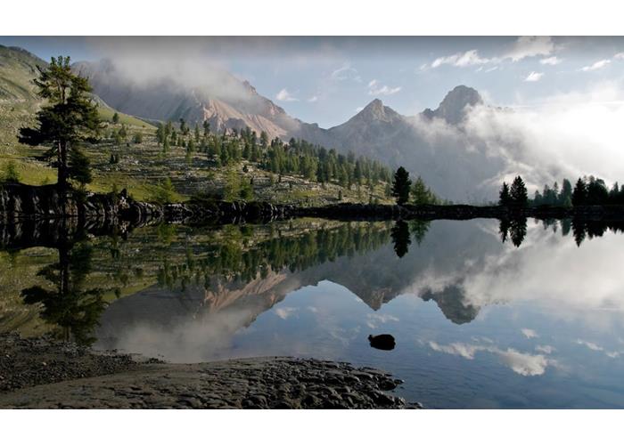
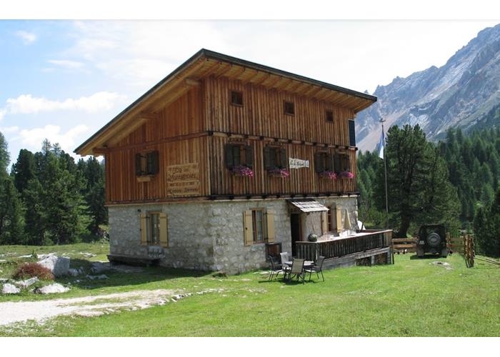
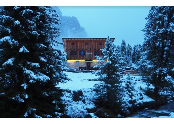
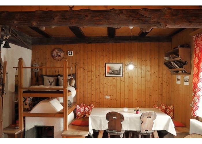
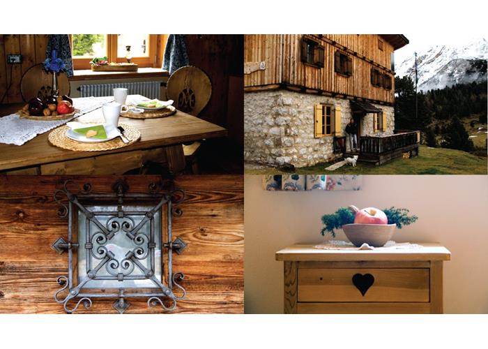
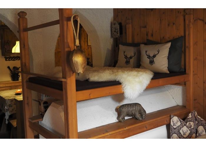
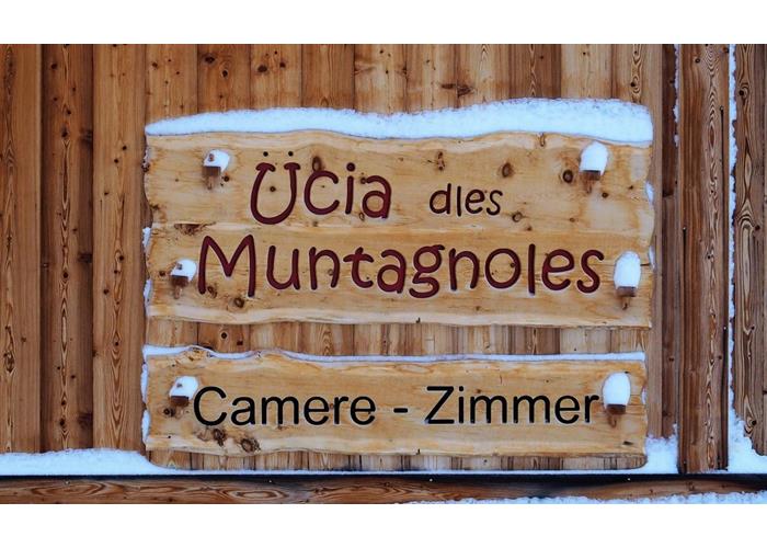
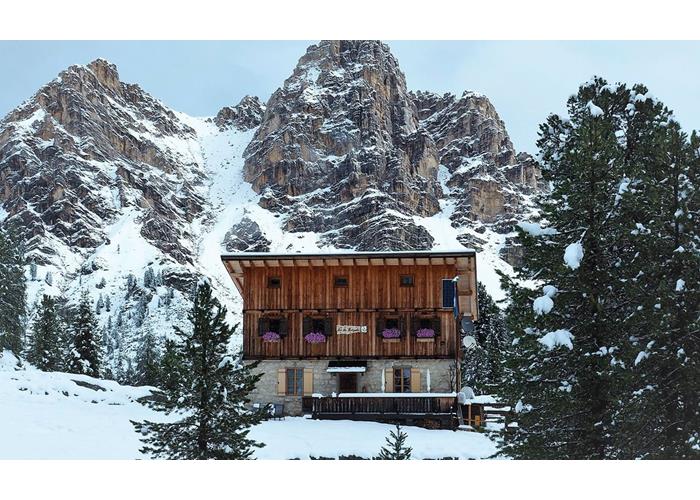
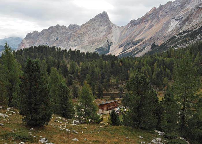
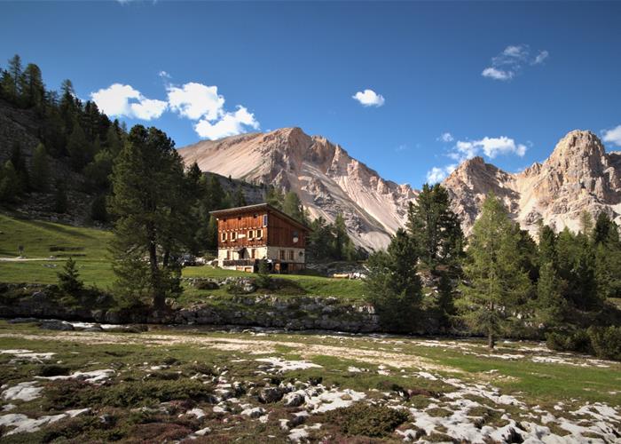
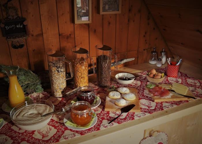
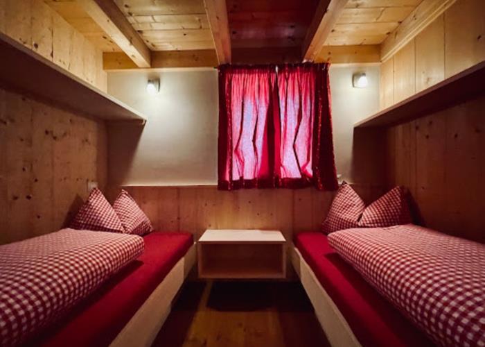
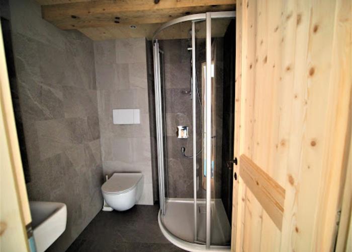
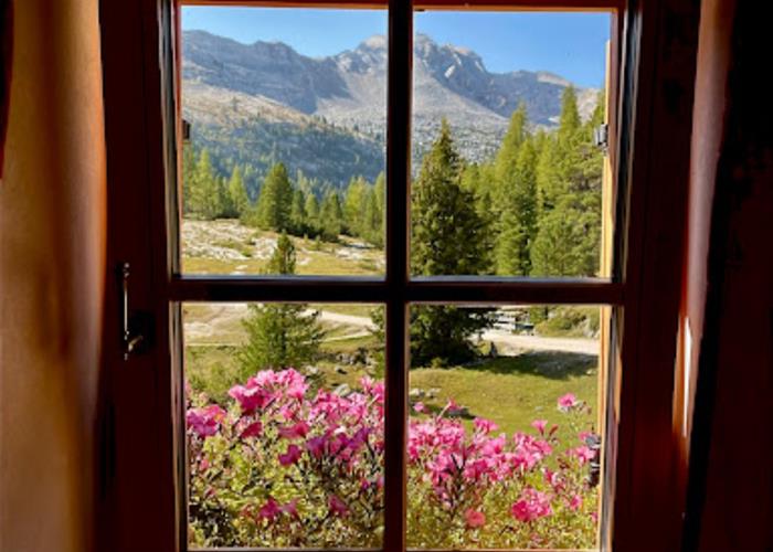
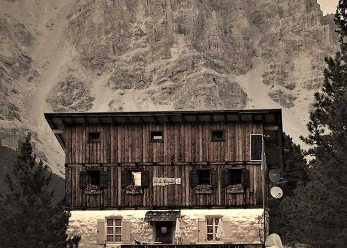
Rustic and welcoming hut in the heart of the Fanes Sennes Braies Natural Park.
Read everything
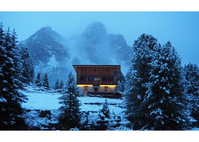
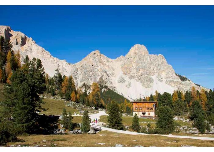
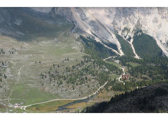
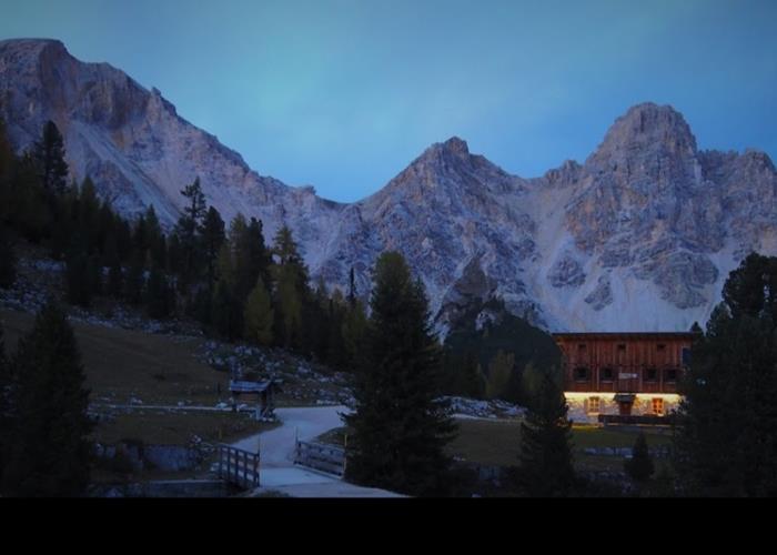
The refuge is located at 2,022 m in the Alpe di Pices Fanes / Fanes Piccola, on the old military road that connects Pederü to Cortina d'Ampezzo.
Col Bechei de Sora (2794 m)
From the refuge to the Ju de Limo and the lake. Turn left (east) on an obvious path, but not numbered, which climbs to the green shelf (2565 m) between 10 lower "Spalto" and the upper rocks of Col Bechei, also known as Parei; there are the remains of an artillery post.
Leave the path to get up on the left on the steep slope and reach the panoramic summit of Col Bechei de Sora without technical difficulties.
Time required: from one and a half to two hours for the ascent.
Difference in altitude: 750 m.
Difficulty: easy excursion.
Equipment: for mountain tours.
Monte Castello (2760 m)
From the Fanes refuge on the war road in 20 minutes to Ju de Limo (2172 m) and down south to the Gran Fanes hut. At the fork, continue briefly to the right (west), towards Ju da l'Ega. Soon you take path N ° 17 to the left (indication).
Shortly after, turning to the right (south), you will find the direct path to Valun Blanch (partly marked with yellow signs and with the triangle of the Alta Via delle Dolomiti 1, variant).
Following the path you enter the Valun Blanch, then passing under the impressive walls of the Cime Ciampestrin; finally he trudges up the steep scree to reach Monte Castello, visible from afar, under whose summit is the "Fixed Bivouac of Peace".
The summit of Monte Castello (2817 m) remains reserved for rock climbers (grade II and III climb); but already from the trenches you can enjoy a beautiful view of the Tofane and Val Travenanzes.
On the way back, the way of the outward journey goes back. Those who want to continue along the "Via della Pace" under the west walls of the Furcia Rossa, see the excursion (9).
Time required: two to three hours for the ascent.
Difference in altitude: about 790 m.
Difficulty: easy excursion.
Equipment: for high mountain tours.
Monte Casale (2894 m)
As in the previous excursion up to Monte Castello. Continuing on the same path towards the south, you reach the last rocks of Monte Casale. Leaving the path to the left, continue on the old war access, somewhat ruined, which leads to the top in 5 minutes; up there was a lighthouse at war with its cave.
Time required: about three and a half hours for the ascent.
Difference in altitude: about 920 m.
Difficulty: easy excursion.
Equipment: for high mountain tours.
Monte Cavallo (2912 m)
As in the previous excursion up to Monte Casale. Continuing on the same path you touch the Forcella Casale (from where the path 17, high way of the Dolomites, descends precipitously on rotten rocks, debris and scree to the bottom of the Val Travenanzes).
From Forcella Casale, going up the serpentines on the right, you can reach the summit of Monte Cavallo in a few minutes.
Time required: about four hours for the ascent.
Difference in altitude: about 940 m.
Difficulty: easy excursion.
Equipment: for high mountain tours.
Cima di Furcia Rossa III (2791 m)
Cima di Furcia Rossa III can be reached from three sides, on three old war paths, partly equipped (therefore reserved for those who already have mountaineering practice, do not suffer from vertigo, are equipped with a lanyard and carabiners for self-belaying). From the Fanes refuge, proceed as for the excursion (2) up to the junction with signpost 17 and stay on the former military road until its end, in the maneuvering area and indicators, at the foot of the northern buttress of the Furcia Rossa.
From there you have three possibilities:
a) From the square, head left towards Monte Vallon Bianco following the path (marked VB). At the small spring (former kitchen) continue to the right (path marked FR) on beautiful ledges, then descending along the stairs to the saddle between Furcia Rossa II and Furcia Rossa III. From the saddle of the vertical ladders exposed on the east wall they lead to the ridge of the mountain; climbing it on the south side you reach the top.
b) From the signposted square, you go directly to the west base of Furcia Rossa III. Through a gully (fixed ropes) you reach easier terrain and, going up the long north ridge of the croda (signs FR), you reach the top. It is the simplest route, even if tiring, with some difficulties only in the initial gully.
c) From the square, continue to the right on path 17 to the flat pasture at the beginning of Valun Blanch. Turn left, laboriously climbing the slope without a path, until you come across the road (marked FR) that descends from Monte Castello (Bivacco della Pace). On that one rises along the stairs, arriving on the easy summit back and then to the summit.
Time required: from two and a half to three and a half hours for the climb, depending on the route chosen.
Difference in altitude: about 820 m.
Difficulty: via ferrata of medium difficulty, for experts free of vertigo.
Equipment: for high mountain excursions; car lanyard and carabiners secure.
Cima di Furcia Rossa II (2703 m)
From the Fanes refuge to the square with directions; continue to the left towards Monte Vallon Bianco, on the path marked VB as in the previous excursion (5a).
From there you go up to the debris cirque between Furcia Rossa I and Furcia Rossa II.
At the junction for Monte Vallon Bianco continue straight, arriving at the former upper station of the Furcia Rossa cableway.
Continuing on the well-marked path you will reach the "Baccon-Baborka fixed bivouac"; from the bivouac, rising towards the west, you can reach the summit of Furcia Rossa II in a few minutes.
Time required: from two and a half to three hours for the ascent.
Difference in altitude: about 740 m.
Difficulty: easy excursion.
Equipment: for high mountain tours.
Mont Vallon Bianco (2687 m)
As for the previous excursion (6) to the debris cirque between Furcia Rossa I and Furcia Rossa II. There you turn left onto the path marked VB, first uphill, then downhill to the notch between Furcia Rossa and Monte Vallon Bianco. Following the serpentines, you reach the steel bridge and then the other depot, from which you can easily reach the vast summit clearing of Monte Vallon Bianco, with the display of artillery in the cave.
Time required: from two and a half to three and a half hours for the ascent.
Difference in altitude: about 720 m.
Difficulty: an easy excursion; but with exposed passages, which require a firm step and absence of vertigo.
Equipment: for high mountain tours.
Piz d'Lavarela (3055 m)
From the Fanes refuge to the Ju de Limo and the Gran Fanes hut. Continue south-west on the old military road. Skirting the north edge of the valley towards a large landslide, you pass the remains of the "Gran Fanes deposit" and the "diversion station" of the cable car from the Great War; on the south side of the valley floor you can see the foundations of the genius deposit.
Shortly before Ju da l'Ega, near the huge blocks of the landslide, turn right (west) onto a path that leads to the Busc da stlü (hole to be closed). Following the white-red signs, you cross the desolate valley enlivened by a small lake, reaching a saddle.
Turn right (north), first zigzagging up the scree and then a path; then on a marked and somewhat exposed ledge you reach a terrace to the right. Continuing to rise, at the end up another path and a gravelly gorge, you touch the small saddle between the forerunner (with cross and panorama) and the main peak.
Time required: 4 to 5 hours for the ascent.
Difference in altitude: about 1100 m.
Difficulty: medium difficulty excursion, which requires sure-footedness, absence of vertigo and rock climbing.
Equipment: for high mountain ascents.
Way of Peace
The Via della Pace runs along the eastern chain of Fanes, from Monte Vallon Bianco to Monte Cavallo. The branches leading to the individual peaks have been described in previous hikes and everyone can combine them according to their resistance and preferences. Only extraordinarily trained and expert mountaineers can complete the entire traverse of the Group (eg: Fanes Refuge - Monte Vallon Bianco - Furcia Rossa II - Furcia Rossa III - Monte Castello - Monte Casale - Monte Cavallo - Fanes refuge) in a single day.
For medium-sized hikers who are quite fit, we recommend for example the routes Furcia Rossa II and (Monte Vallon Bianco, which require between 6 and 8 hours round trip. Another combination suggested for hikers with good legs is that of the routes (2) Monte Castello, Monte Casale and Monte Cavallo for which it takes about 6 to 7 hours, between there and back.
For those who are already familiar with via ferrata and conveniently equipped, we propose the Furcia Rossa III excursion and precisely the crossing from east to west in which the stairs on the east wall, slightly overhanging, are covered uphill.
The continuation of the ridge route, from Monte Cavallo to Punta Fanis Nord, must be reserved for mountaineers able to proceed safely on friable rocks without insurance. The metal ropes fixed in 1975 are destroyed.
Sas Dles Diesc (Cima Dieci 3023 m)
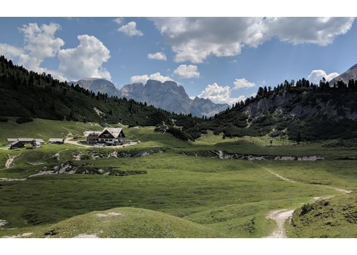
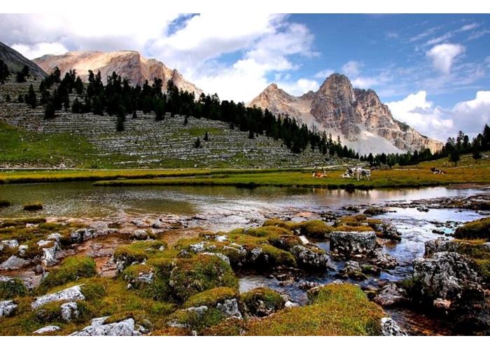
Ascension to a peak over 3000 meters with an immense panorama and majestic Dolomite scenery. Very interesting pulpit overlooking the Val Badia and the culminating point of a long ridge that marks the upper limit of the vast basins where the FANES REFUGE (Alpe di Fanes Piccola) is located.
Characteristics: Long and tiring ascension which certainly represents an achievement of undisputed value for every mountaineer; at the foot of Cima Dieci stands the legendary Castle of Fanes, stronghold and residence of the King of Fanes and Princess Dolasila.
Difference in height and time: Itinerary on mountain paths with a rocky bottom (limestone pavement), with ample development, never particularly steep; difficult summit rock block (approx. 100 m) tamed by a fixed metal rope that still requires skill and experience; difference in altitude of 1000 m, 6 hours (AIR).
Description: From the Fanes refuge (2060 m) take path no. 7113 up to a nearby ridge, where you continue to the left on path no. 7. This rises for a long stretch through the grassy basins or on the typical limestone pavement. Continuing in a southerly direction, you arrive at Furcela de Sas dla Crusc, 2609 m (Forcella Monte Croce); possibility to go down to the S. Croce Hospice (route reserved for expert hikers).
Turning sharply to the right (signpost without number) and walking along the ridge you will arrive just below the summit of Ciaval, 2908 m (Monte Cavallo). The ascent to this summit is optional and easy; However, caution is recommended on the crest because on the left the rocky walls plummet. The following stretch, along the ridge, requires foot safety and absence of vertigo. Finally, you reach the rocky summit equipped with fixed ropes.
You can go back to Fanes by going down in a direct line (first stretch along a steep scree at times paved) to the Fanes Castle, which is passed to the right to reach the path of the climb.
High route of the Dolomites
From Lake Braies to Belluno
It is the first high route traced in 1966 for a total length of about 150 km that can be covered in about 11 days.
The ascents or aided routes indicated in the notes are optional and do not make up the itinerary, they are noted for their beauty and for those who have the skills and the possibility would like to expand the itinerary.
Given the length of the excursion we indicate some sites that deal with presenting the Alta Via delle Dolomiti n ° 1.
from www.enrosadira.it
from www.dolomiti-altevie.it
from www.dolomiti.it
In Val di Fanes by mountainbike:
Riding your mountain bike along fantastic itineraries on the Alpe di Fanes.
The Dolomites, mountains of wild beauty and incomparable sweetness: our fabulous world. Mountain bikers will find their paradise here: green meadows and many suitable, steep, bizarre, wild, stony, beautiful and exciting routes.
in summer you can push yourself upwards, where the air is fresh and crisp.
Unforgettable adventurous days on a mountain bike in the Fanes park, in a landscape of unique grandeur even for professionals, whose rare beauty is a source of amazement even for the little ones.
All dirt roads can be covered by mountain bike, other marked routes are: through the Fanes Valley and the Limo Pass from the road between Carbonin and Cortina d'Ampezzo, from the Capanna Alpina (San Cassiano - Valparola) or from the Lagazuoi area (P.sso Falzarego) and for the more experienced there are also long and technically demanding routes to reach Val Badia.
Open from June to October.

Enter our shop to buy our gadgets, items for the mountains, stay packages in one of the mountain huts that are part of mountbnb.
Buy now
![]()
![]()