Sesto | Telefono: 3896125485
![]()
![]()
€ 31,50 - 61
€ 60 - 85
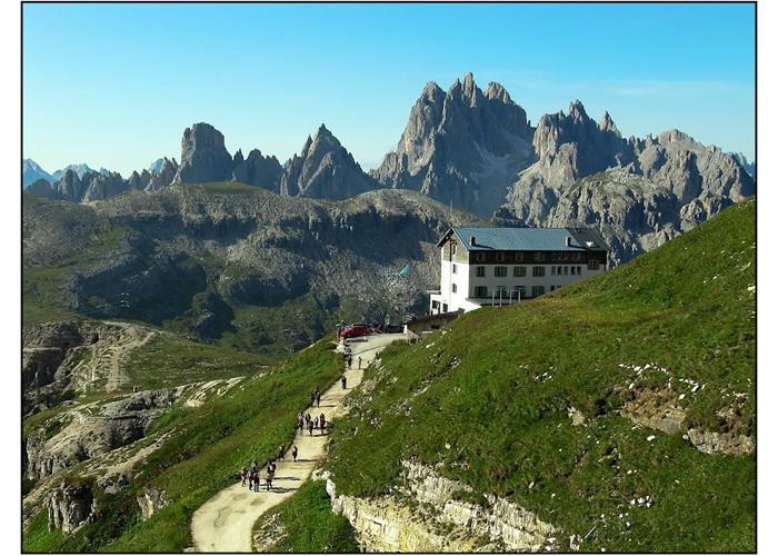
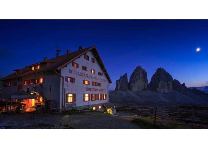
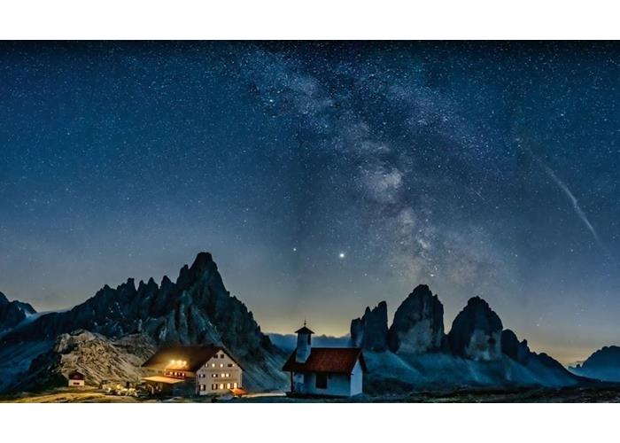
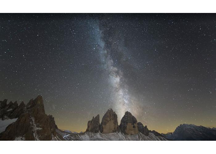
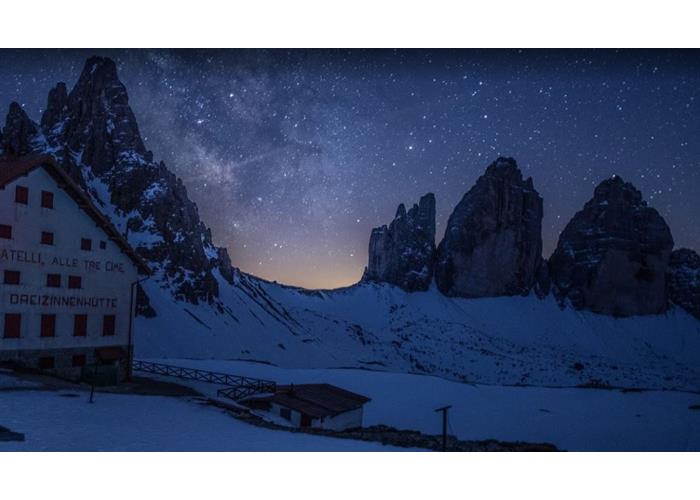
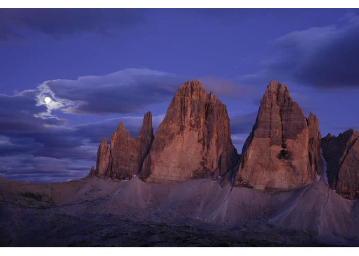
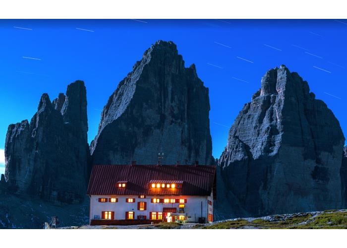
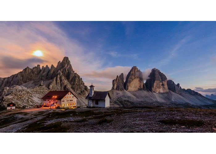
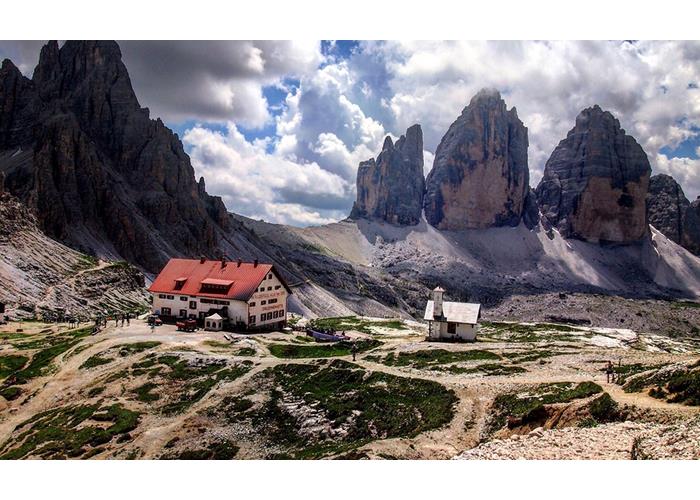
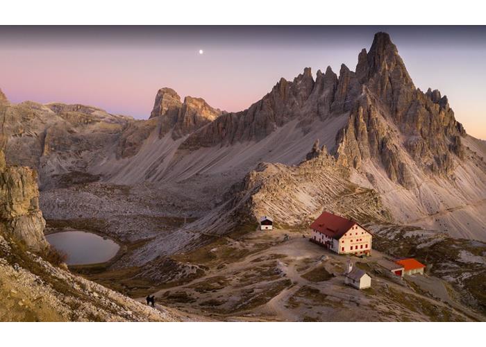
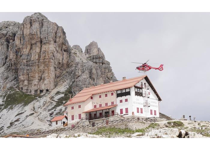
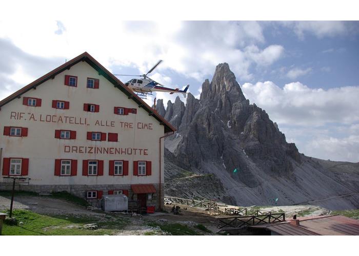
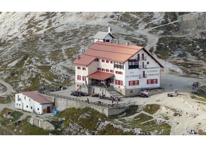
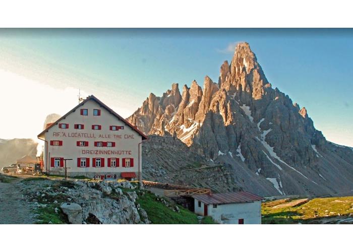
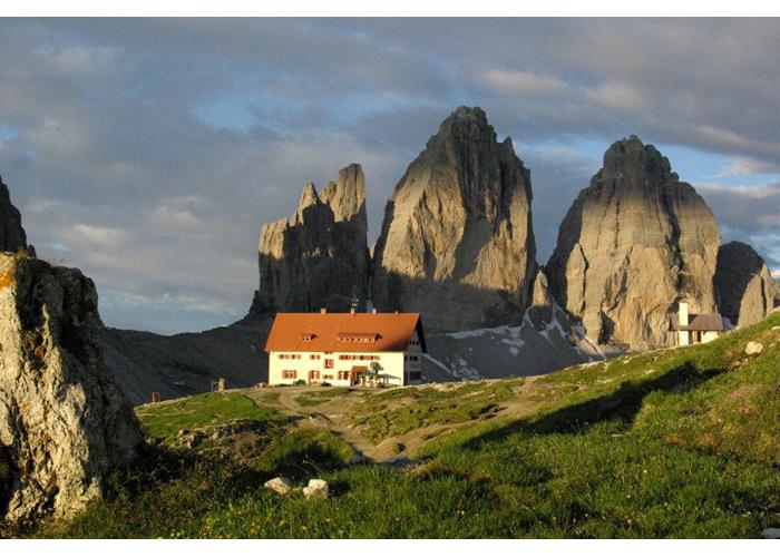
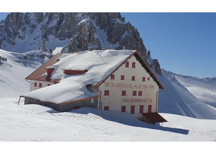
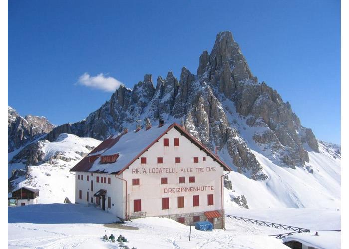
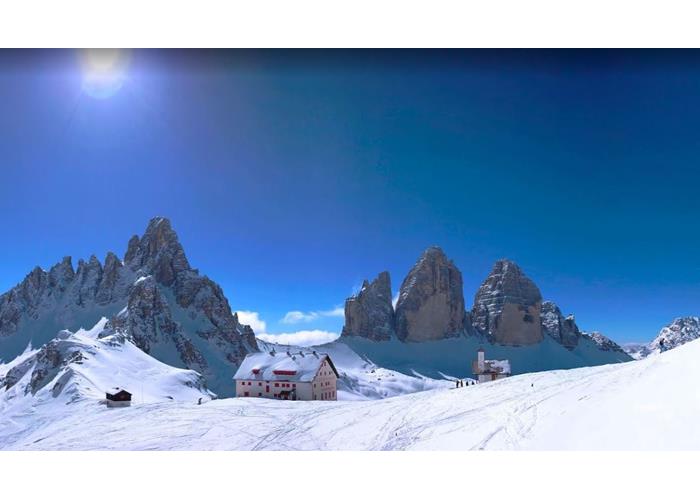
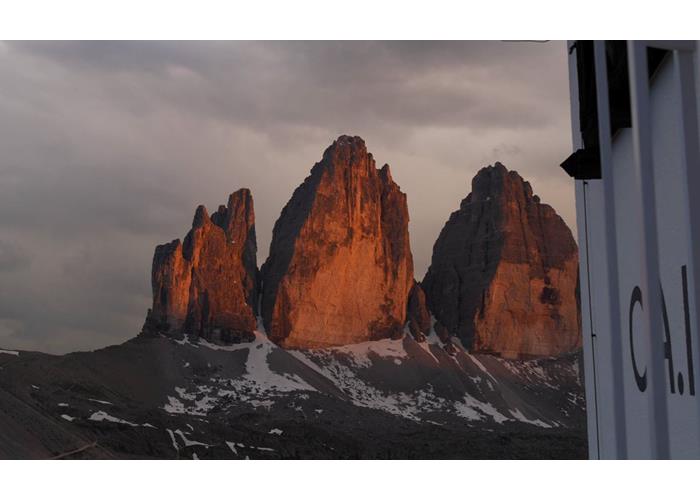
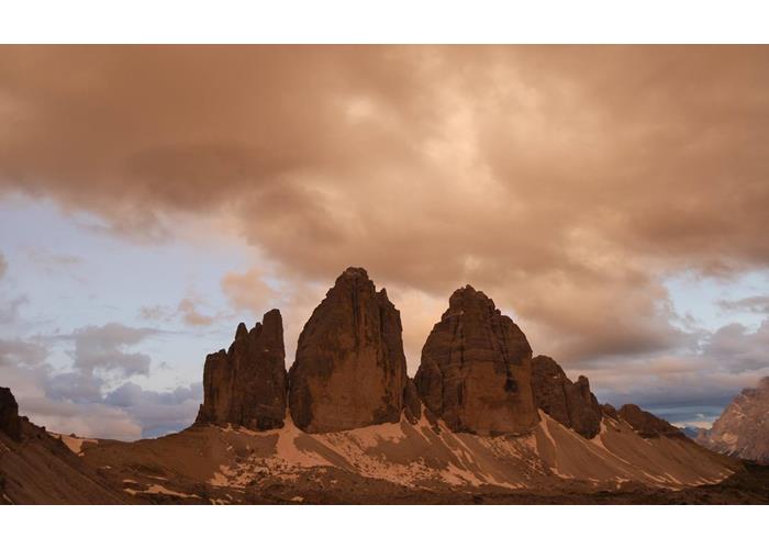
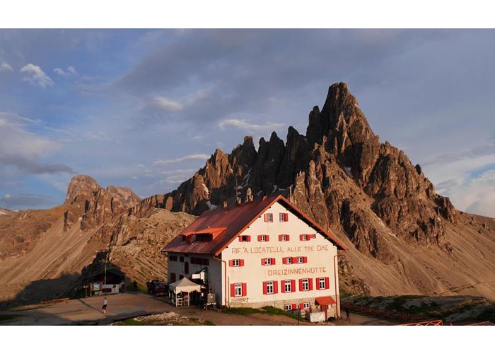
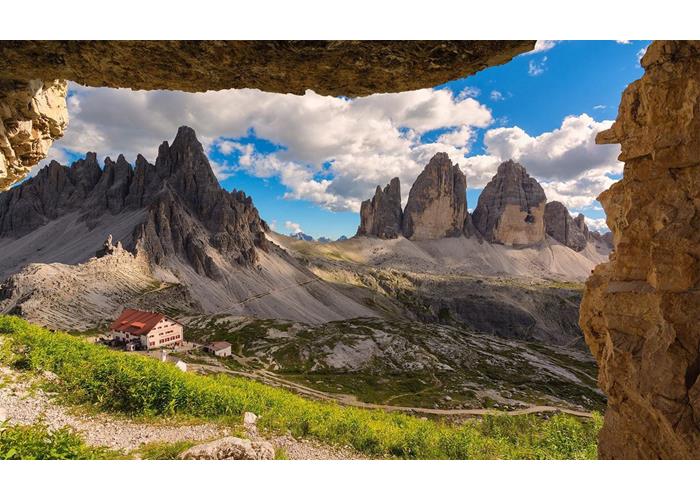
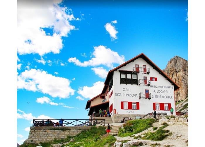
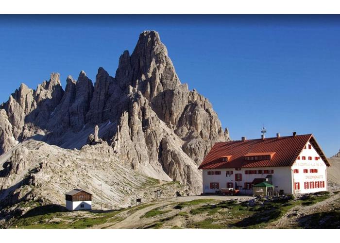
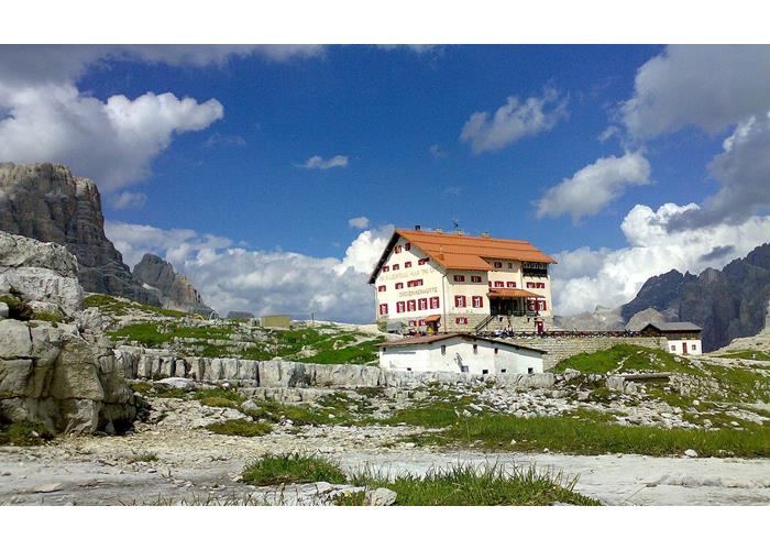
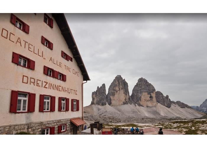
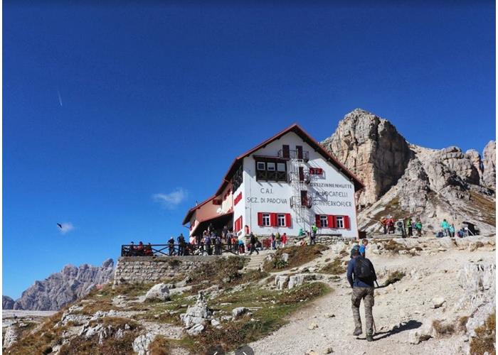
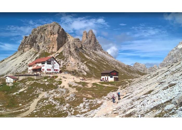
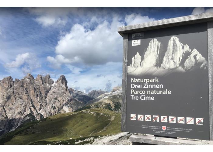
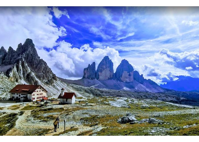
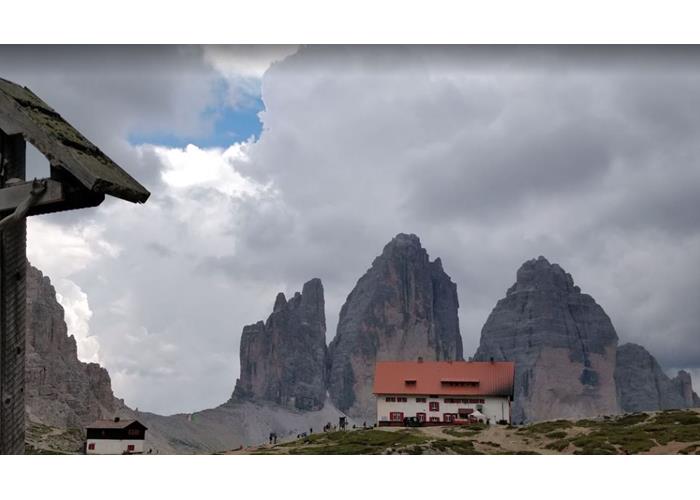
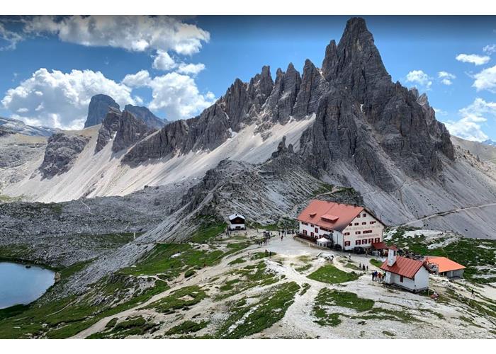
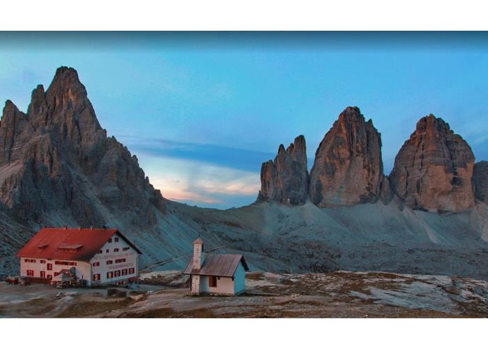
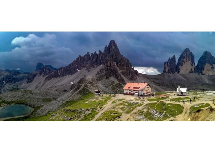
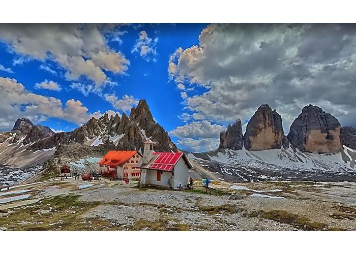
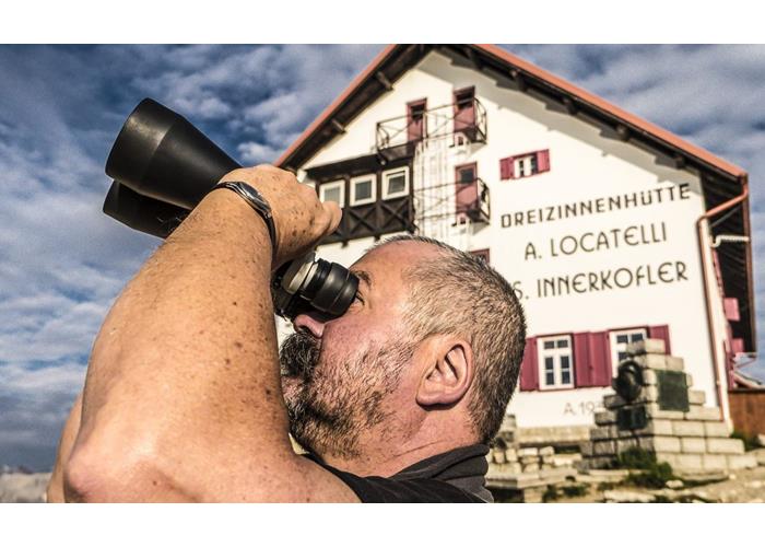
At the base of the symbol of the Dolomites: the three rocky obelisks of the Dolomites formed by limestone. The Locatelli Innerkofler Hut, built in 1882 by the Alta Pusteria section of the Deutscher und Österreichischer Alpenverein and destroyed in 1915 during the Great War, was rebuilt in 1922 by the Alta Pusteria section of the South Tyrolean Alpine Club to be expropriated in 1923 and given to CAI Bolzano for management . Rebuilt in 1935 and inaugurated in 1937 by the proprietary sections of Bolzano and Padua of the Italian Alpine Club and named in memory of the pilot and CAI academic Antonio Locatelli, whose name has recently been joined, on the initiative of the CAI Section of Padua, with that of the guides Sepp Innerkofler, manager of the first Dreizinnenhütte.
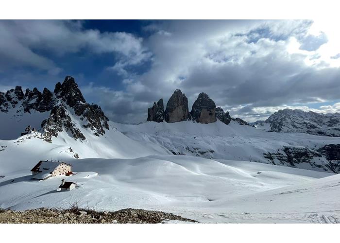
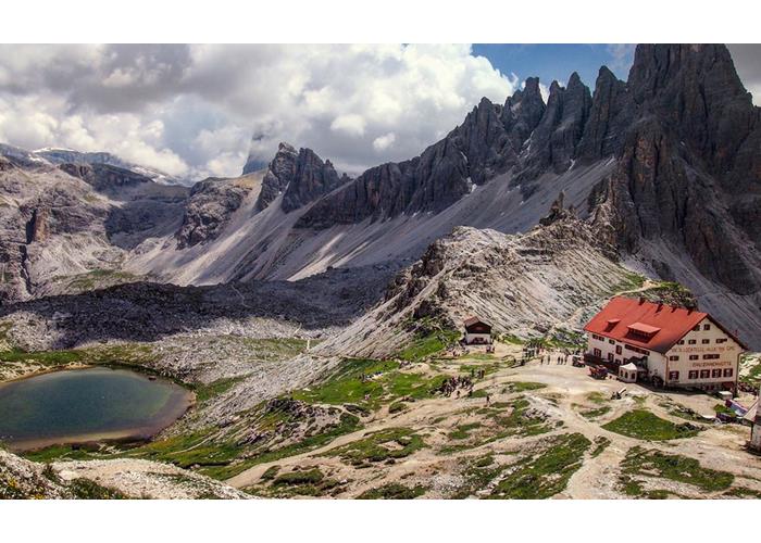
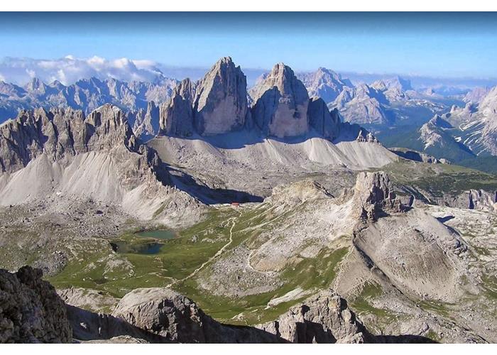
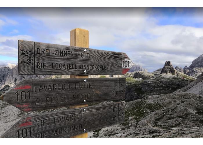
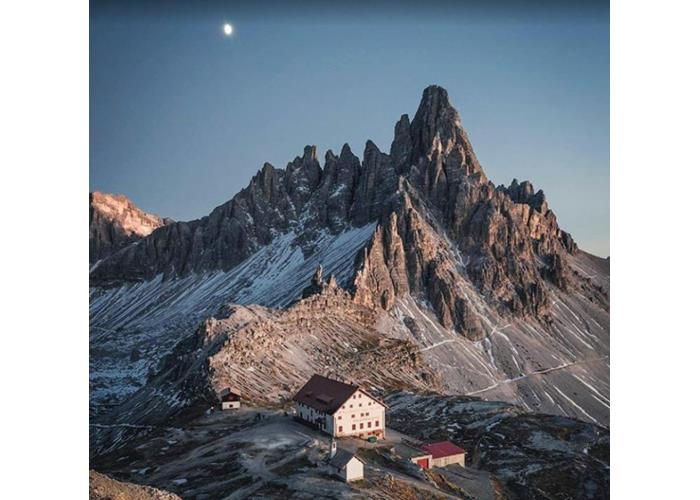
Read everythingThe Locatelli refuge can be reached in a short time from the Auronzo refuge, which is connected to Misurina (fraction of Auronzo) by a toll road. The minimum walking time required to reach the Locatelli refuge from the Auronzo refuge (parking) is approximately 1 hour and 40 minutes. On the other hand, the connection with Sesto via the Val Fiscalina is more demanding. It can also be reached from Lake Landro in three hours. From Rifugio Auronzo 2330 m, 1.45 am E: with sent. 101 for ref. Lavaredo, F.lla Lavaredo, 2454m, and to the refuge. E: with sent. 105 for Col di Mezzo branch, 2315 m, for Piani di Rienza and junction with sent. 102, 2220m, and shortly to the Dalla Val Fiscalina refuge: from Sesto/Campo Fiscalino, 1454m, 2.30-3 am E: with sent. 102 for Capanna di Fondovalle, 1540m, and then right for Val Sassovecchio to Alpe dei Piani, 2314m, and shortly to the refuge. From the parking lot, the path marked N.103 leads into the valley, with a pleasant and flat, until you reach the Fondovalle Refuge at 1,548 m. To the right, path N.102/103 climbs slightly up to a crossroads, where you turn left and then take path N.103. The route is rather steep, but well developed and leads to the Comici Hut, Zsigmondyhütte in German, which is located at 2,224 m. Here the view of Cima Undici and Cima Dodici is wonderful. From Rifugio Comici, the Alta Via N.101 continues through Passo Fiscalino, to Rifugio Pian di Cengia and Pian di Cengia. The Pian di Cengia refuge is already located at 2,522 m. Here, in the Sesto Dolomites, the Dolomite front developed during the First World War: it is therefore no wonder that along the path you can still find evidence of that time. From the refuge, to the north, the path leads through the debris with a somewhat steep descent, to then become a beautiful and flat excursion with a breathtaking view of Punta Tre Scarperi up to the Locatelli refuge at the Tre Cime at 2,405 m. The view of the famous Three Peaks of Lavaredo, symbol of the Dolomites, a UNESCO World Natural Heritage Site, is unique and of incomparable beauty. The descent leads north-east along path N.102 above the Bodenalm hut with the two lakes higher up, and then through the beautiful Val Sassovecchio, which is dominated by Cima Una, up to the Fondovalle Hut in Val Fiscalina, then continuing up to the parking lot. The best time to plan this excursion is when your hiking holiday takes place between the end of June and the end of September.
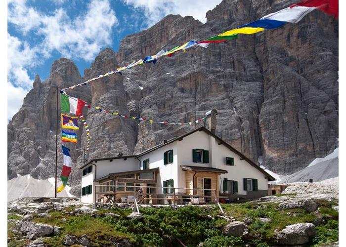
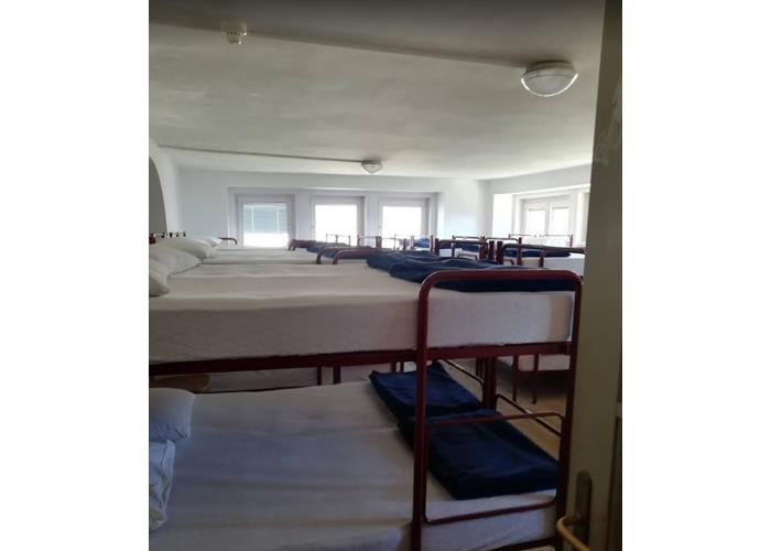
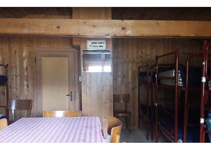
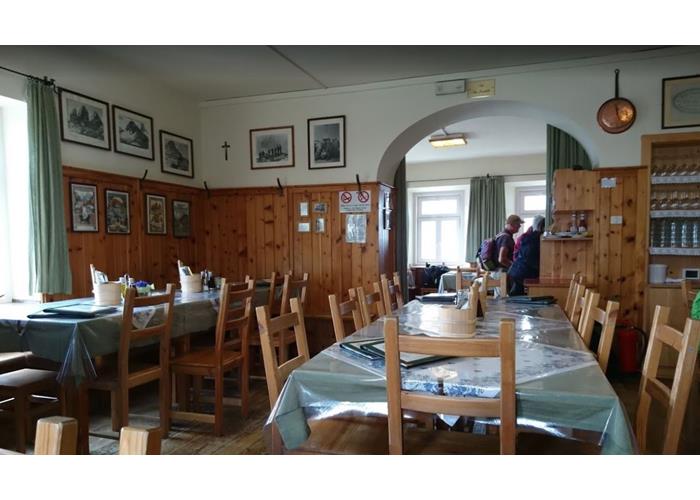
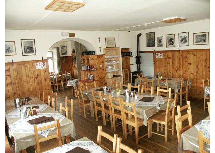
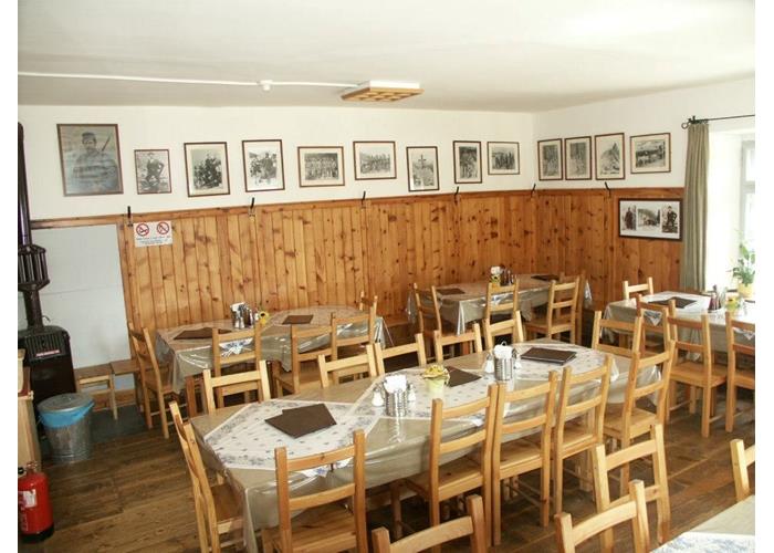
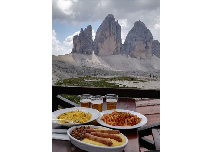
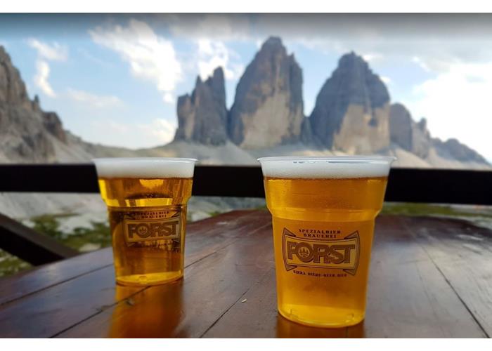
Read everythingInternal/external refreshment places: 140 seats inside, 200 outside FAVOR! Our fixed radio link telephone is no longer usable! For reservations: https://www.dreizinnenhuette.com/rifugio-locatelli.php
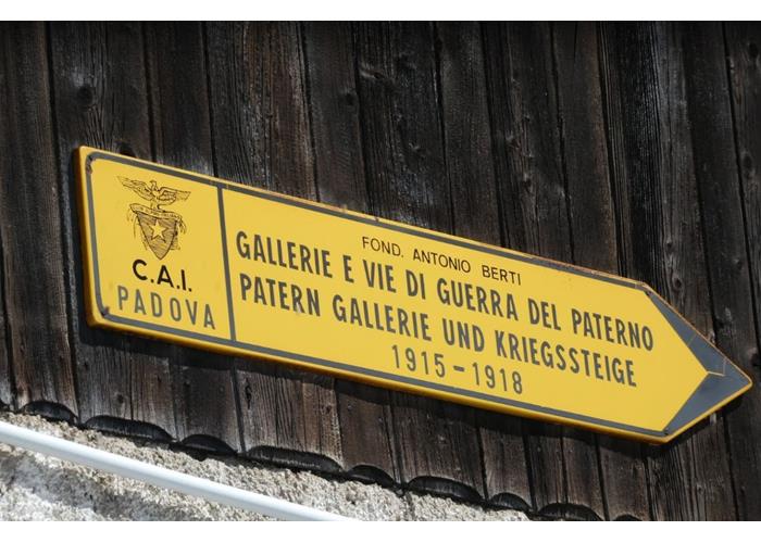
Read everythingTo the Pian di Cengia Refuge, 2528 m, 1.15 am T: with sent. 101 to Forcella Pian di Cengia, 2522m, and along the ridge shortly to the Al Monte Paterno refuge, 2744m, 2.30-2.45 am EEA: with sent. s.n. towards the north crest of Monte Paterno and then through the War Galleries up to the Forc. del Camoscio, 2650 m, and to the left with sections aided to the summit Alla Torre di Toblin, 2617 m, 1 hour EEA: with sent. s.n. at the base of the Tower and then up the stairs to the top; return by the common route, 0.30 am EE: equipped in the exposed points and return to the Giro del Monte Paterno refuge, 3.15-3.45 am E: with sent. 101 at Fork. Lavaredo, 2454 m, for Laghetti and left with sent. 104 at Fork. Pian di Cengia, 2522 m, junction with path 101 and for the Alpe dei Piani return to the refuge
Read everythingFrom the last Saturday of June to the last Sunday of September

Enter our shop to buy our gadgets, items for the mountains, stay packages in one of the mountain huts that are part of mountbnb.
Buy now
![]()
![]()