Termeno sulla strada del vino | Telefono: +393382820065 | Cellulare: +393403610785
![]()
![]()

€ 26 - 39
€ 44 - 56
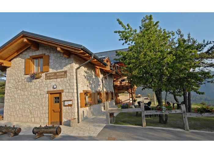
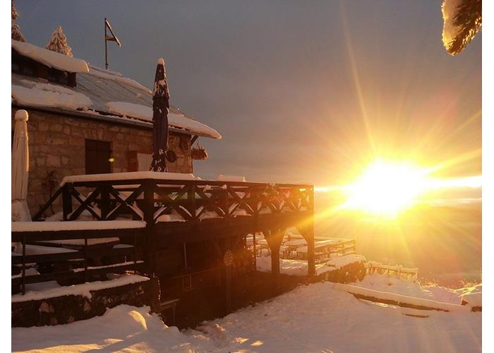
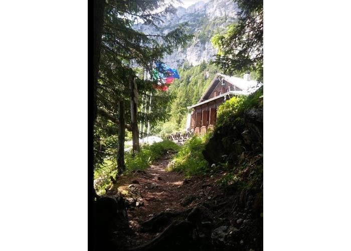
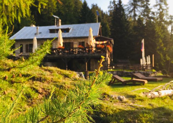
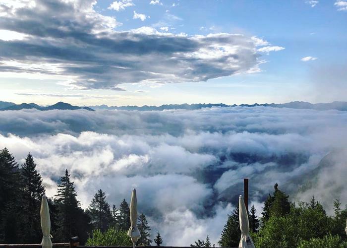
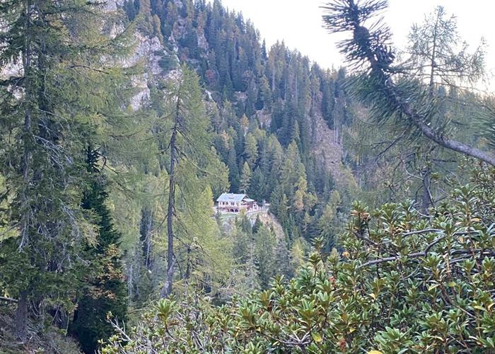
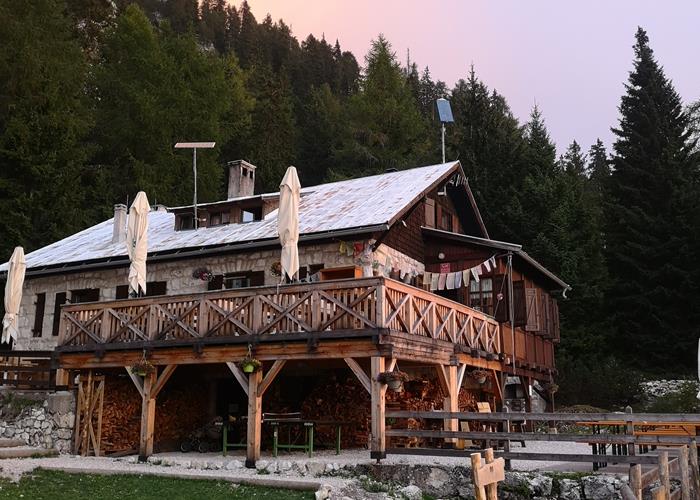
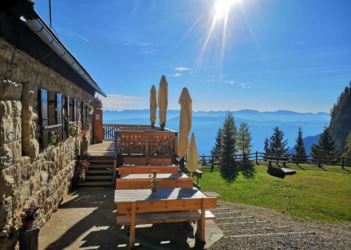
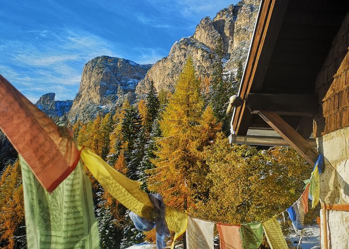
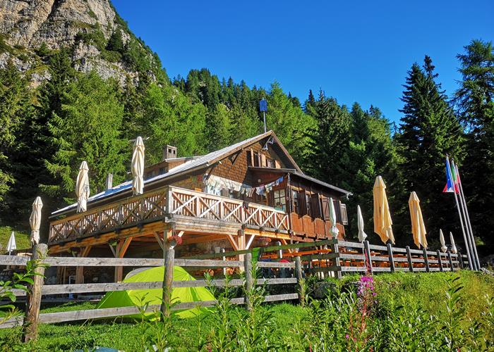
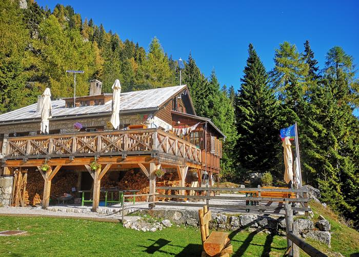
The Oltradige / Überetscher Hütte mountain hut enjoys an extremely panoramic position over the Adige Valley. Its easy access makes it suitable for families with small children or strollers, who can have fun in the playground in 20 minutes of comfortable walking. From its terrace overlooking the valley you can admire in their entirety the Dolomite groups of the Latemar, the Pale di San Martino and the Marmolada, the entire Lagorai chain up to the Cima d'Asta group. The original structure of the refuge has remained intact, dating back to 1913, so as to offer the hiker the experience of visiting a "Refuge of the past". It is a reference point for the ascent to the highest peak of the Mendola group through the Roen via ferrata which starts near the refuge. It is an easy-to-follow aided path, particularly suitable for the first approaches to the Dolomite via ferrata. The refuge can also be reached by mountain biking and EMTB through wooded and panoramic paths, where, with a little luck, it will be possible to spot herds of chamois.
Read everything
Accesses:
1) from Passo della Mendola, path 500, medium-easy, h2: 00, difference in altitude approx. 400m (possibility to shorten the route by using the chairlift, in the area of Golf Courses).
2) from Val di Non, drive past the village of Amblar and follow the signs for "Malga Romeno"; from the latter, an easy 30 min walk.
3) from Cavareno, medium, h 3, altitude difference 700m
4) from Termeno to the Inferno valley, difficult, 4:00 am, altitude difference 1500m
5) from Caldaro via Prazöller Steig, difficult, 4.30 hrs, altitude difference 1300m
6) from Castelvecchio (Caldaro) via Langer Steig, medium-difficult, h 3, altitude difference 1200m
HOW TO GET HERE: The Mendola chain in Trentino Alto Adige is the natural watershed between the Adige valley and the Val di Non, the refuge is easily accessible from the Val di Non along a comfortable and flat forest road that can be covered on foot in just 15 minutes. Or from the Mendola pass along an enchanting path that winds through fir and larch trees with a travel time of about two hours (possibly halved using the chairlift).
Access from Val di Non: Val di Non is conveniently connected to the Brenner motorway (A22) through a modern expressway that uses brand new tunnels and viaducts. For those coming from the north we recommend the Mezzocorona / San Michele all'Adige motorway exit, while from the south it is more practical to exit at the Trento Nord tollbooth. Take the first part of the valley to the town of Dermulo. Turn right towards Fondo / Passo della Mendola up to the town of Cavareno, and reach the village of Amblar. Then follow the signs for Malga Romeno. A forest road for the most part paved leads to the meadows of the malga, here you can park your car and comfortably reach the refuge in 15 minutes, following the numerous indications.
Access from the Mendola Pass: The Mendola Pass (1330m.a.s.l.) connects the upper Val di Non with the town of Caldaro in the Bassa Atesina, from Bolzano follow the signs for Caldaro / Termeno. Coming from the south, take the panoramic Strada del Vino da Egna (motorway exit) to Caldaro. From the town there are clear signs for the pass. It is also possible to reach the Mendola pass using the historic funicular which will take you from Caldaro to the pass with a spectacular route (http://www.oltradige.it/it/attrazioni/la-funicolare-sul-monte-mendola.html ). From the pass, reach Campi da Golf (ample parking and chairlift departure). Follow the edge of the track to the Mezzavia refuge, follow the obvious signs (path 521) to Malga Romeno, from here you can easily reach the refuge in 15 minutes.
MOUNTAIN BIKE:
For the more trained and those who are not satisfied, you can come and visit us immediately before embarking on the descent of the route "Le malghe del Monte Roen" proposed in the book "Mountain Bike Routes" by Luigi Chini (Arca Edizioni) of which we report a free extract.
Internal capacity approx. 30 / outdoor seats approx. 80
Read everything
Ascent to Mount Roen (2116m) via an easy via ferrata (nr. 523, 1 h) or normal path (nr. 500, approx. 1:30 h).
Crossing to the Predaia refuge, medium, path 500, h 4, altitude difference 400m uphill and 700m downhill.
The via ferrata of Mount Roen:
The via ferrata is a route for expert hikers. To be able to travel in safety conditions, via ferrata equipment is required: harness, via ferrata set and helmet (possibly available at the refuge).
Itinerary: From the refuge, follow path no. 523 which climbs in a zig zag way, rising up to an altitude of 1835, at the start of the aided path. Aided by the ropes you face and climb the wall until you reach the grassy ridge. Between meadows and mountain pines (signpost) you then reach the top of Mount Roèn (2116 m - about 1 hour from the refuge).
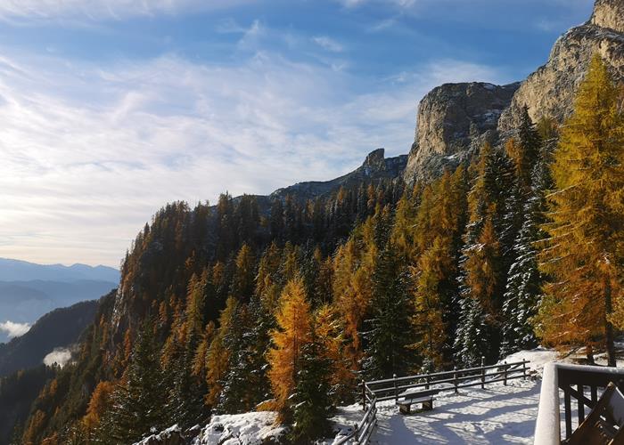
From the top the view is wonderful. You can admire: the Brenta Dolomites, the Adamello and the Carè Alto, the Ortles, the Breonie Alps, the Aurine Alps, a large sector of the Dolomites, the Lagorai as well as the panorama on the bottom of the Val d'Adige with the city of Bolzano.
Descent: From the top, head south to Schwarzer Kopf (Black Head or Big Hind), 2030m. Now to the left for the "Gemsensteig - Sentiero dei Camosci-, n.560, you return to the Oltradige Refuge. You can also descend by following the same ascent route.
Mountain bike:
The less demanding and certainly satisfying itinerary for a season start is the first part of what is freely reported in the book "Trentino in Mountain Bike" by Piercarlo and Renato Margoni (Arca Edizioni) to which we refer for a more exhaustive consultation.
Yes Follow the first part of this itinerary to Malga Romeno and from here briefly to the Oltradige Refuge.
Excursions and crossings:
The possible combinations are numerous, the well-marked paths offer the possibility of connecting peaks and points of interest in the area. Access to the refuge from the Mendola pass (golf course location) is an excursion suitable also for untrained people who will reserve a great satisfaction once you reach our panoramic balcony on South Tyrol.
For lovers of wide horizons, the coveted traverse that from the town of Mezzacorona through a spectacular ridge route, runs through the Mendola chain passing through the peaks of Roccapiana, Cime di Vigo, Corno di Tres up to Monte Roen. Also for this itinerary the refuge is a strategic point of support and refreshment.
Horseback riding:
The area lends itself very well to horseback riding. Both in Amblar and in Ruffrè-Mendola there are riding stables with availability of horses for all experiences and numerous offers of tineraries and guided tours.
Open from mid-May to October
Enter our shop to buy our gadgets, items for the mountains, stay packages in one of the mountain huts that are part of mountbnb.
Buy now
![]()
![]()