Varazze | Telefono: +39 019931304 | Cellulare: +39 3482779622


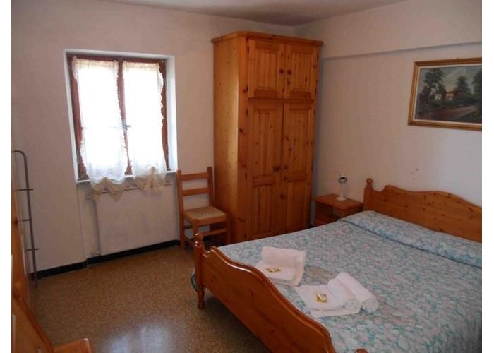

€ 25 - 30
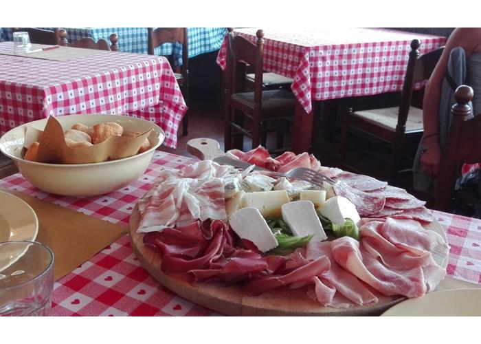
€ 35 - 45
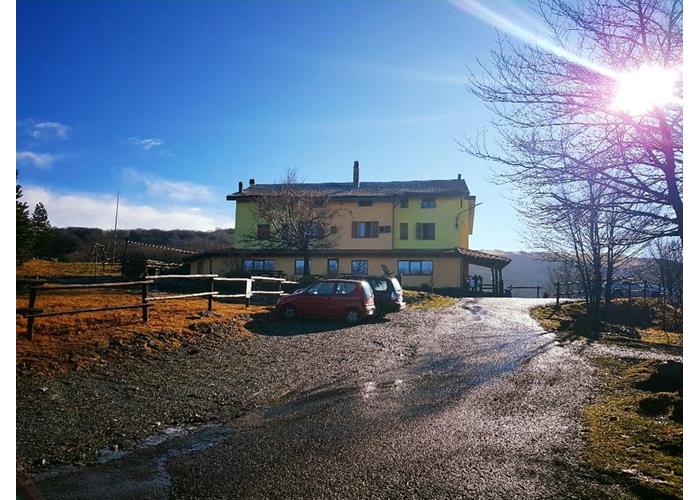
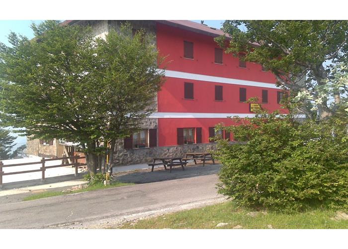
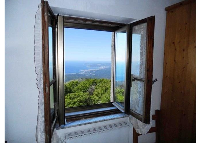
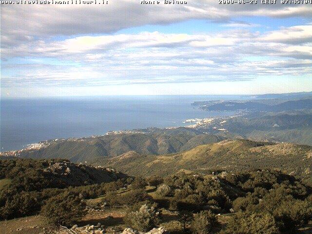
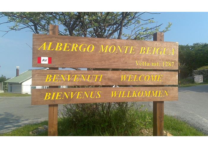
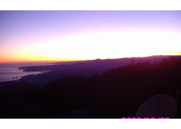
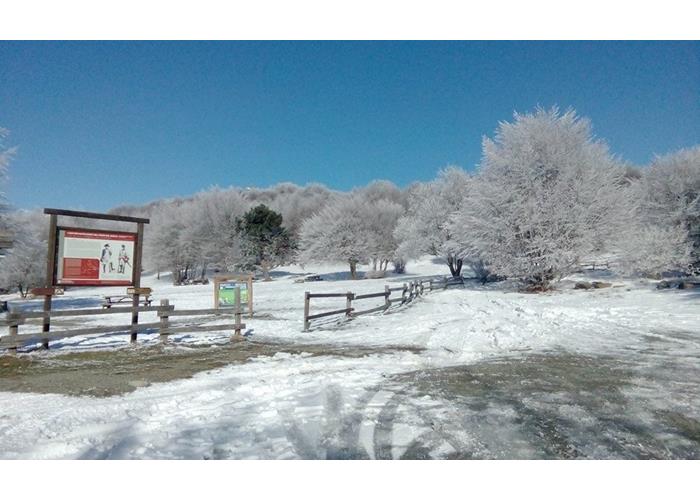
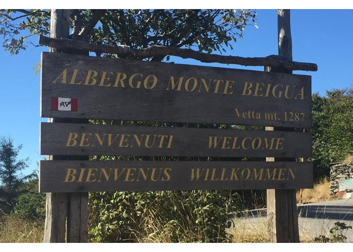
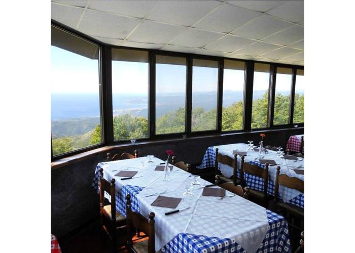
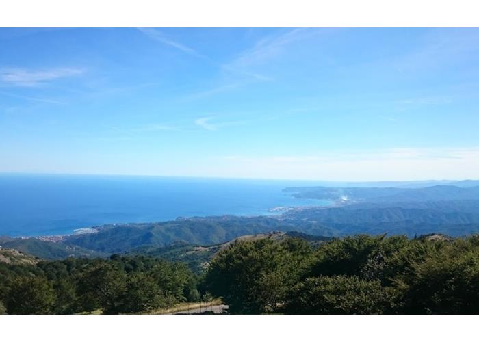
With its splendid breathtaking views of the coast and the Alps, it is located at 1287 m. right at the top of the mountain from which the Beigua Park takes its name, now recognized among the UNESCO Global Geoparks.
Quiet place, in the center of the park of the same name, a starting or transit base for pleasant itineraries that wind along the ALTA VIA DEI MONTI LIGURI or more simply a destination for refreshing excursions (20 minutes by car) from nearby Varazze.
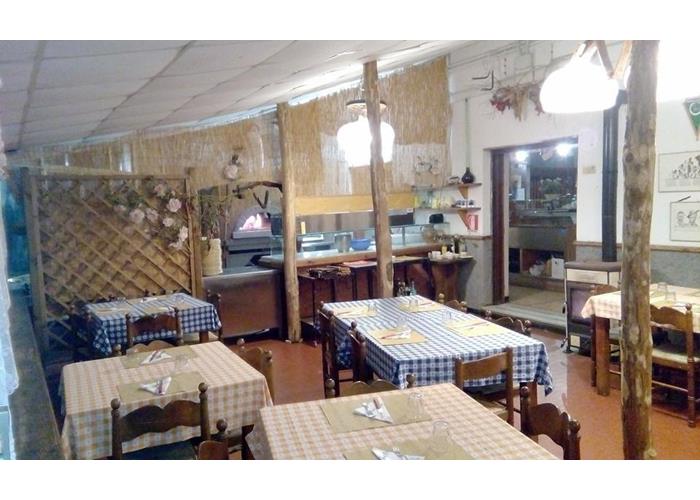
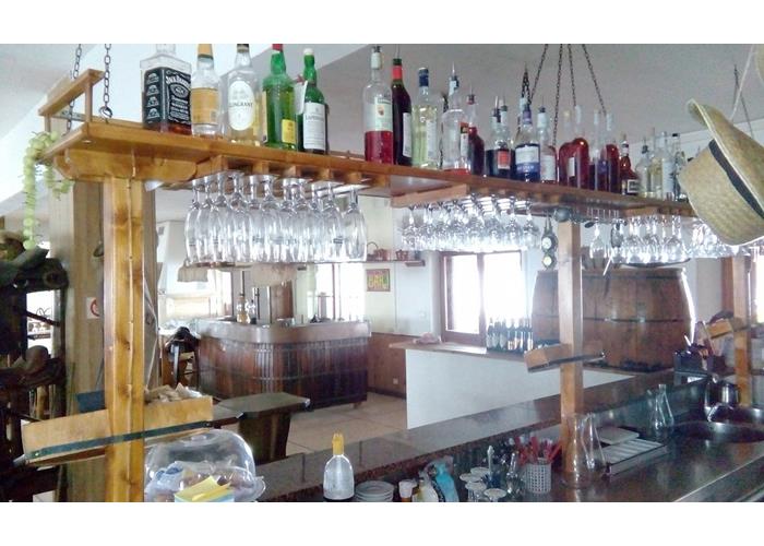
A typical mountain restaurant overlooking the Ligurian Sea, it represents the ideal base for training in the sport of orienteering, horseback riding, gatherings of bikers, motorcyclists, off-roaders and in season for mushroom enthusiasts.
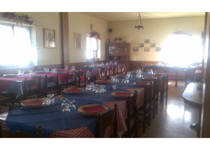
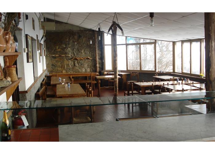
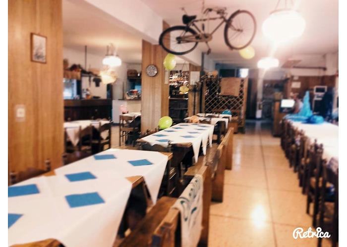
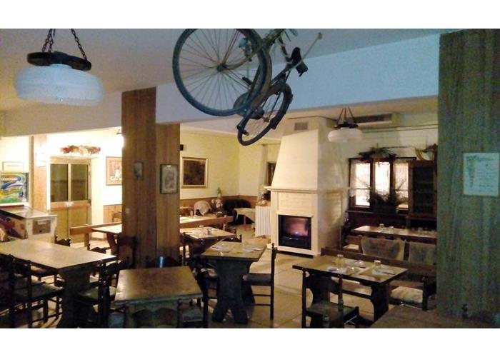
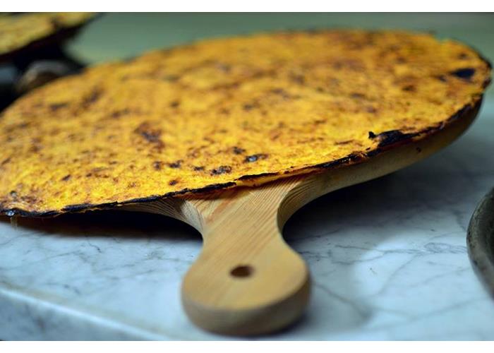
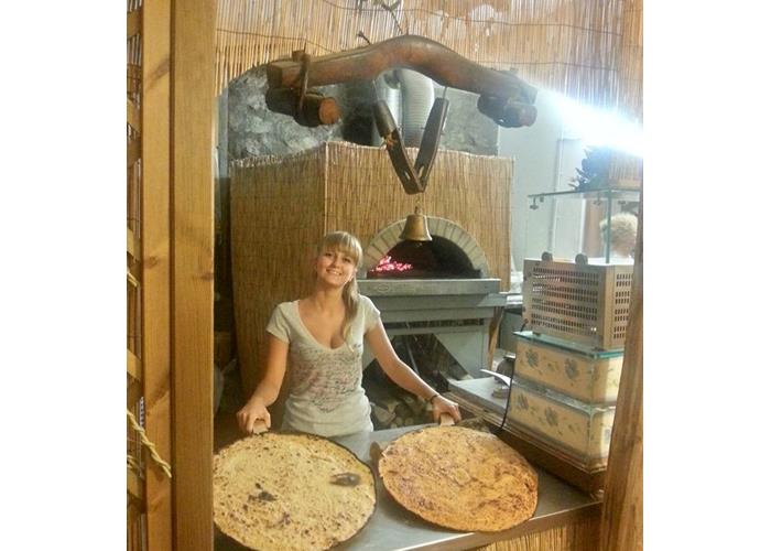
Typical cuisine and pizzeria with wood oven.
CLOSED ON MONDAY
From Varazze (SV) sea side or from Sassello (north side of the Apennines).
FOR THOSE COMING FROM MILAN GENOA DIRECTION XXMILGLIA
EXIT AT THE VARAZZE TOLL FOLLOW THE CENTER DIRECTIONS
FOLLOW DIRECTIONS FOR ALPICELLA/MONTE BEIGUA
FOR THOSE WHO COME FROM XXMIGLIA TORINO SAVONA DIRECTION TO GENOA
EXIT AT THE CELLE LIGURE TOLL-OUT FOLLOW THE DIRECTIONS TO THE CENTER
FOLLOW DIRECTIONS FOR ALPICELLA/MONTE BEIGUA
ATTENTION SATURDAY MORNING PRESENCE IN THE VARAZZE MARKET CENTER
FOLLOW THE DEVIATIONS ON INTERNAL ROADS
VARAZZE (6) - MONTE BEIGUA (1287)
Climb time: 1.45 hours to Faie + 2.15 hours to Monte Beigua
Total time: 7 hours
Signpost: red cross
Departure from the provincial road 542 for Sassello between the two motorway viaducts (6) - Cappelletta del Beato Giacomo (318) - Passo Valle (367) - eastern slopes Bric della Forca - Passo del Muraglione (394) - Faie (456) - eastern slopes of Monte Greppino, Monte Priafaia, Bric Montebè and Monte Cavalli - southern slopes of Monte Beigua - Monte Beigua (Chiesetta Regina Pacis, 1287)VARAZZE (6) - MONTE BEIGUA (1287)
ALPICELLA (405) - BEIGUA CROSS (1267)
Ascent time: 3 hours
Total time: 5.15 hours
Signpost: empty red triangle
Departure from the church square (405) - south-west slopes of Monte Priafaia - east slopes of Bric Montebè - south-west slopes of Monte Cavalli - Piano Giare dell'Olio - Alpicella-Beigua road - Sella del Beigua (1251) - Croce del Beigua ( 1267)
SCIARBORASCA (210) - MONTE BEIGUA (1287)
Ascent time: 3.30 hours
Total time: 6.15 hours
Signpost: red square
Departure from the church square (210) - western slopes Colle Scaggina and Montebello - southern slopes Cima Frattin - Rocche di Vatterasca (960) - Pratorotondo (1108) - south-eastern slopes Monte Beigua - Monte Beigua (1287)
COLLE DEL GIOVO (516) - MONTE BEIGUA (1287)
Ascent time: 3.15 hours
Total time: 6 hours
Signpost: Alta Via dei Monti Liguri
Departure from Colle del Giovo (516) - Costa Verina - Costa della Bandìa - Costa del Giancardo - southern slopes Bric Veciri - Sella del Beigua (1215) - Monte Beigua (1287)
SASSELLO (386) - MONTE BEIGUA (1287)
Ascent time: 4 hours
Total time: 7.15 hours
Signposts: two yellow triangles from Sassello to Monte Beigua; empty yellow square from Monte Beigua to Sassello
Ascent: starting from the town hall square (386) - Bridge over the Rio Sbruggia - western slopes Monte Tremo - Colle Bergnon (816) - Casa della Bandìa (905) - Fosso della Bandìa - Costa del Giancardo - southern slopes Bric Veciri - Sella del Beigua (1251) - Mount Beigua (1287)
Descent: Monte Beigua (1287) - Sella del Beigua (1251) - southern slopes Bric Veciri - western slopes Monte Ermetta - Veirera (979) - Costa Serena - Bastia Soprana - Sassello Cemetery - Sassello (386)
FAIALLO PASS (1061) - MONTE BEIGUA (1287)
Ascent time: 3.15 hours
total time: 6.15 hours
Signpost: Alta Via dei Monti Liguri
Departure from Passo del Faiallo (1061) - Rifugio Albergo "La nuova sul mare" - Casa Tassara - Passo Vaccaria (1115) - southern slopes Rocca Vaccaria - Rifugio Argentea (Cima Pian di Lerca, 1090) - Passo Pian di Lerca - Cima del Pozzo (1103) - Piano del Bric Damè - southern hill of Bric Resonau (1086) - Prato Ferretto - southern slopes Cima Frattin - Pratorotondo (1108) - southeast slopes Monte Beigua - Monte Beigua (1287)
MONTE BEIGUA (1287) - MONTE ERMETTA (1267)
Ascent time: 0.45 hours
Total time: 1.30 hours
We start from the "Monte Beigua" hotel (1287) and follow the Alta Via dei Monti Liguri in the direction of Colle del Giovo. After about 20 minutes of walking, on the southern slopes of Bric Veciri, a trail branches off to the right (faded white trail sign E) that goes up between meadows and beech thickets. Once you reach the southern ridge of Ermetta, proceed north and soon reach the top of Mount Ermetta (1267).
Open from April 1st to November 5th
Enter our shop to buy our gadgets, items for the mountains, stay packages in one of the mountain huts that are part of mountbnb.
Buy now
![]()
![]()